Argentina and Chile
We apologize in advance for the length of this post. We were here for nearly two months and had a hard time editing down.
TL;DR: The Andes are dope.
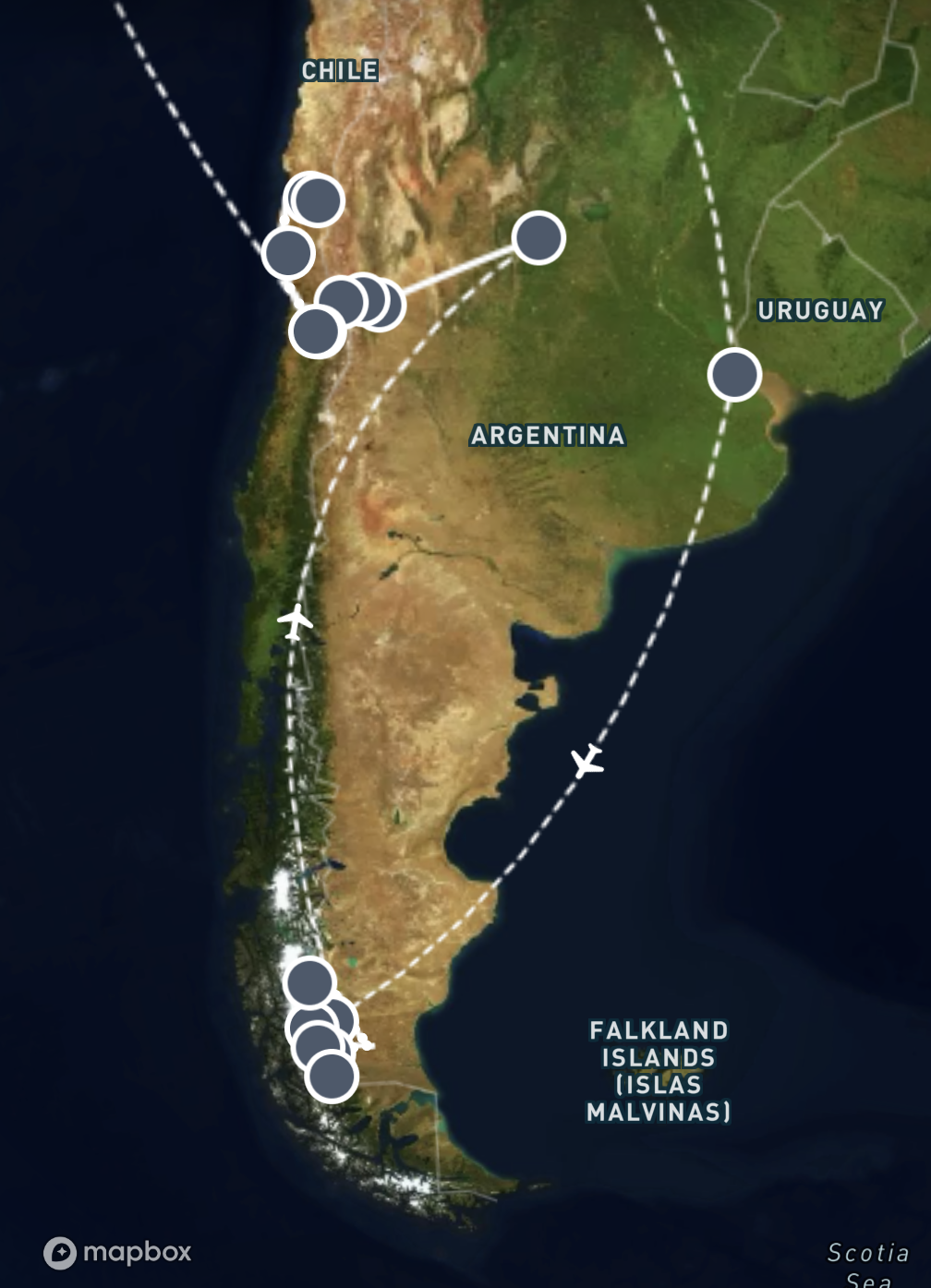
We decided to combine Argentina and Chile into one post not because we think they are not deserving of their own stories, but our itinerary floated over the border quite a few times and we explored both the Argentinian and Chilean side of Patagonia, which refers to the region of the Southern Andes range covering both countries so they did feel like a shared experience to us.
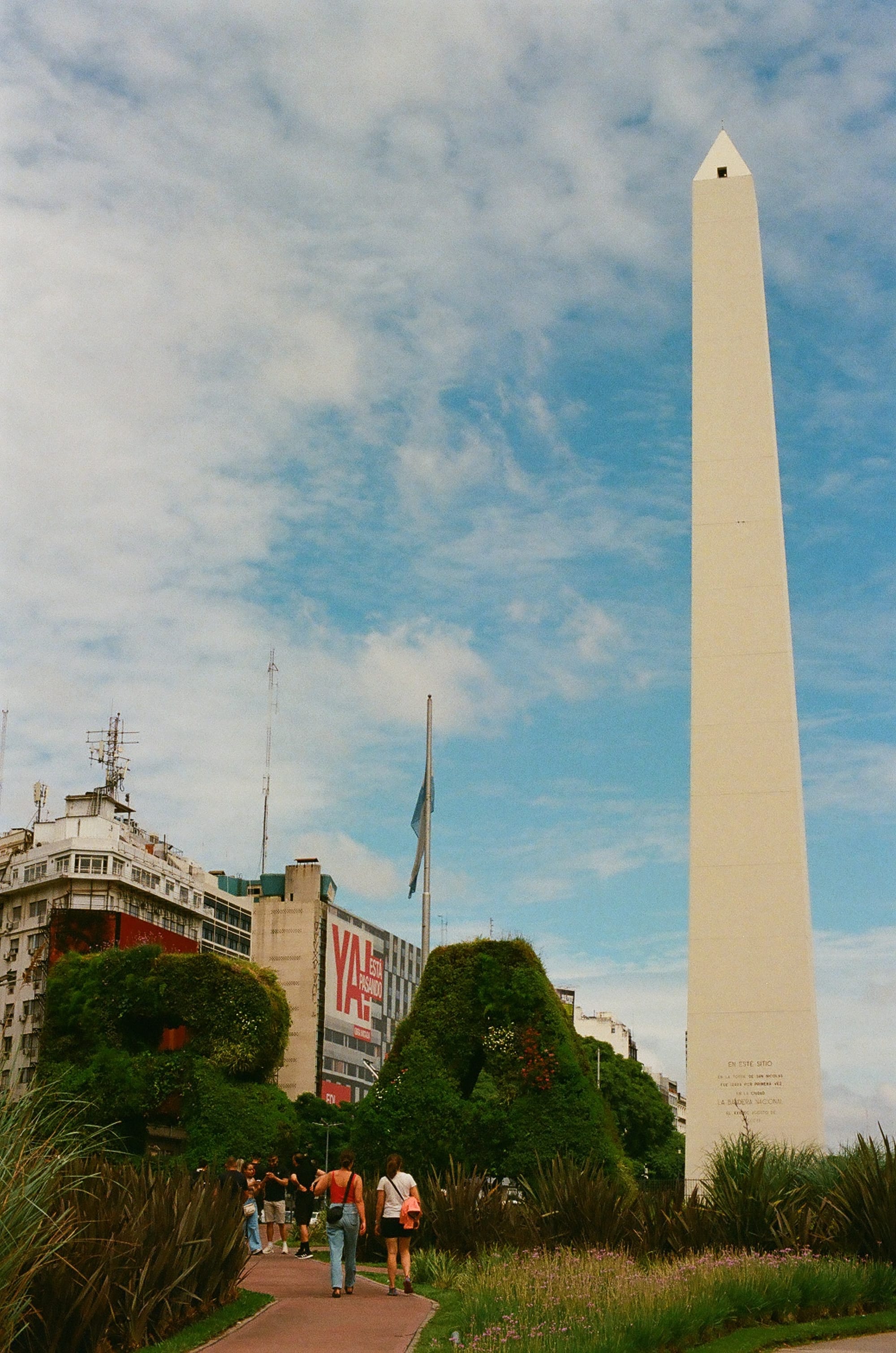
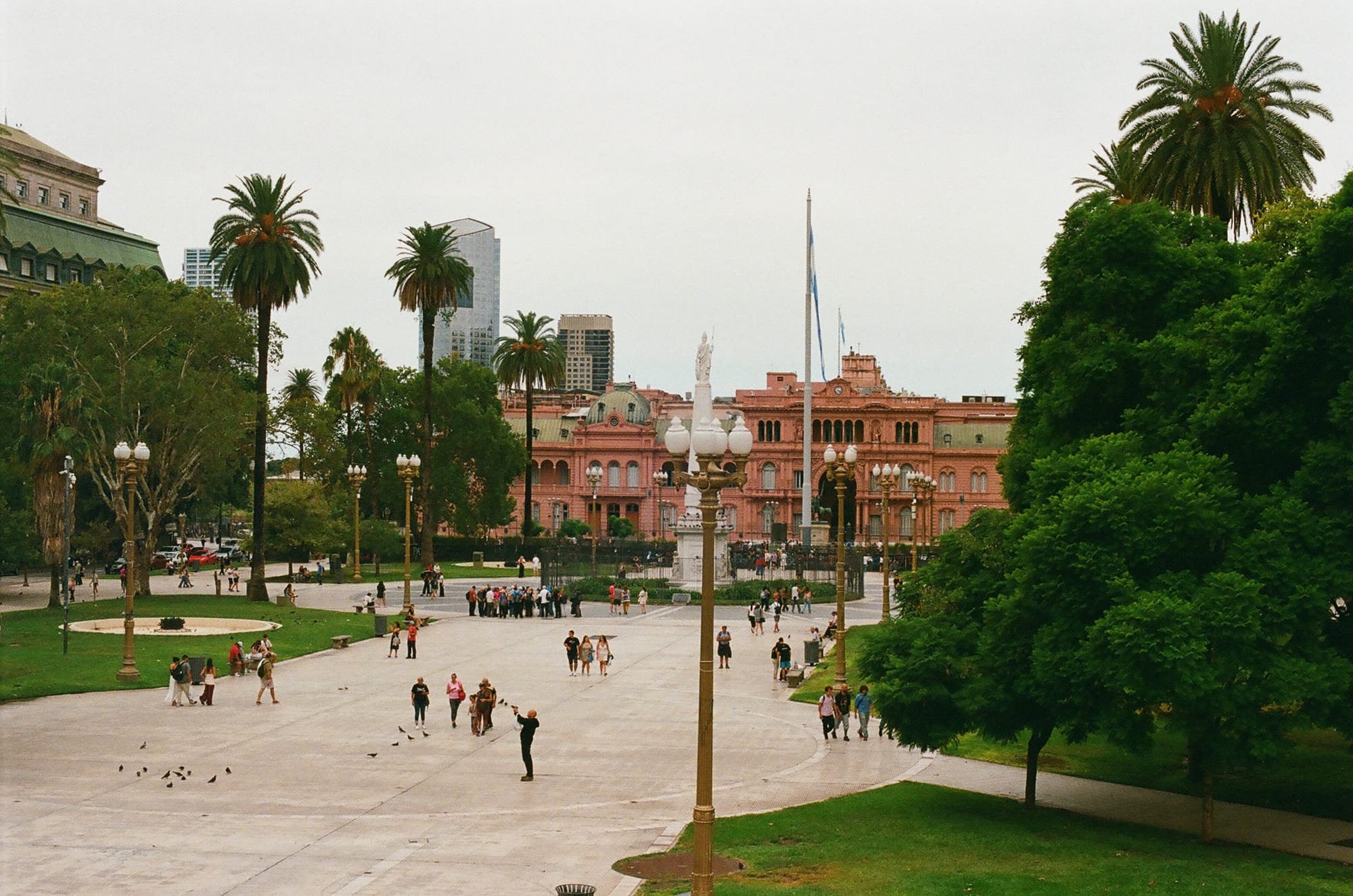
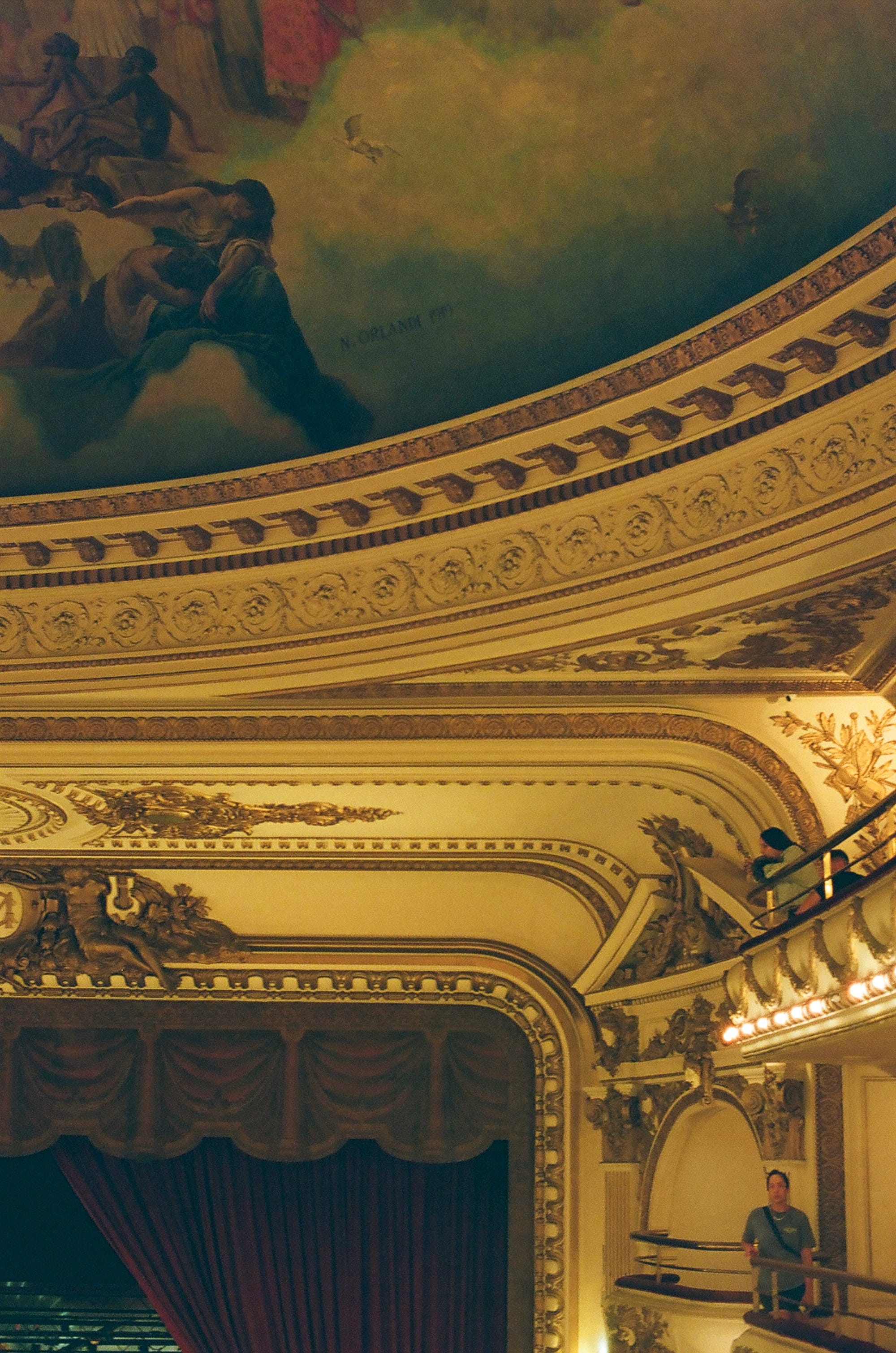
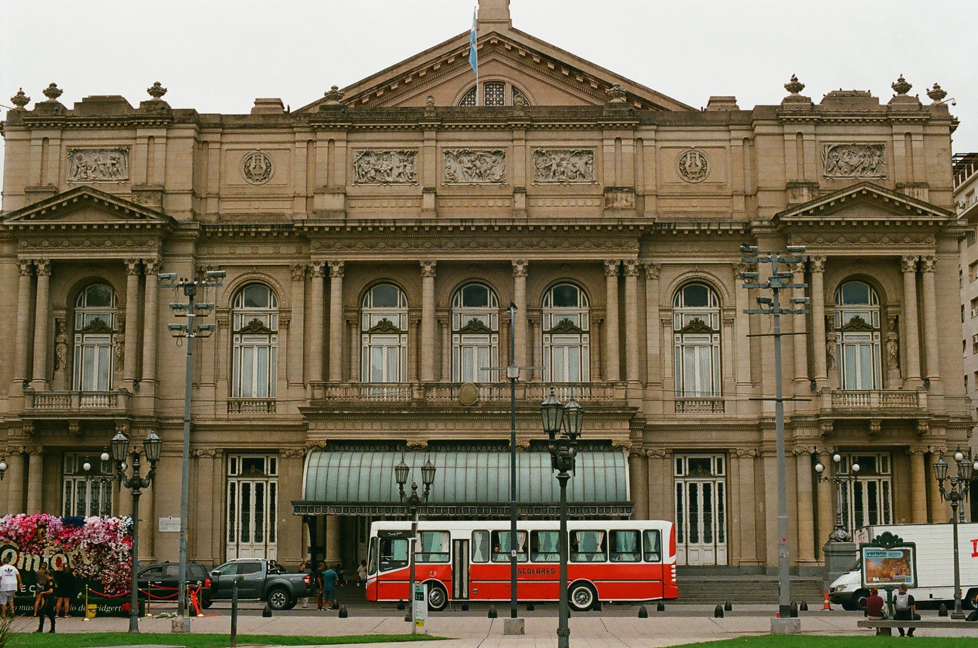
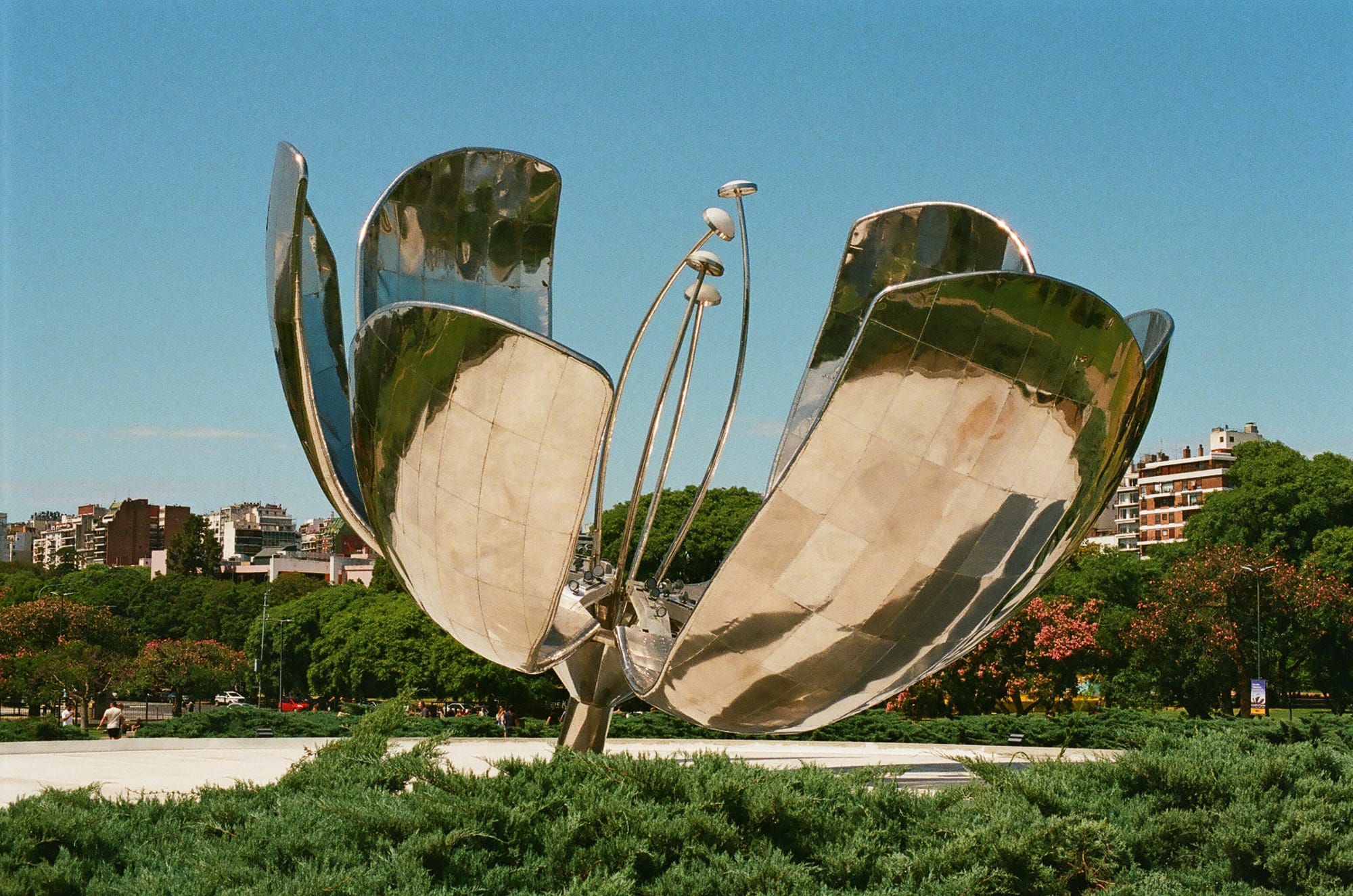
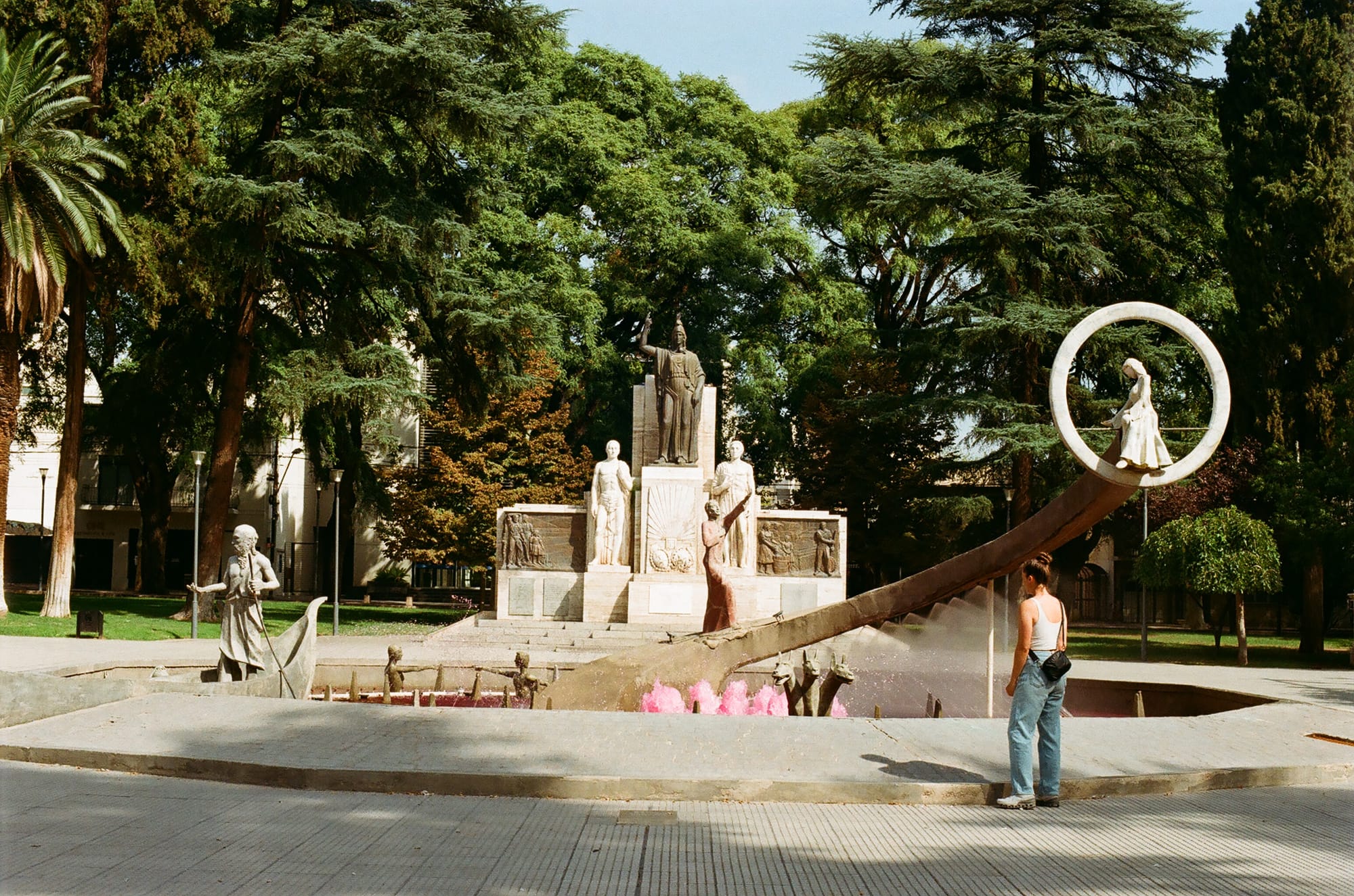
We flew from San Jose, Costa Rica, to Buenos Aires, Argentina and we were excited that our friend from PA school, Alyssa, was able to join us for a couple of weeks! Our time in Buenos Aires was spent hopping from cafè to choripan and rosticeria and asado to hip bars and patio hangs. Buenos Aires is a beautiful city. It’s known as “The Paris of South America” and it really does have a European feel and architecture. It is a very walkable city and we strolled along the Japanese and Botanical Gardens, through the neighborhoods of Recoleta and Palermo. We visited the art museum of Buenos Aires (MALBA) and saw the iconic Obelisk, Plaza del Maya, the El Atenas Grand Bookstore, and Casa Rosada. One noteable cocktail bar was Boticario, which was an old-school pharmacy-themed speakeasy.
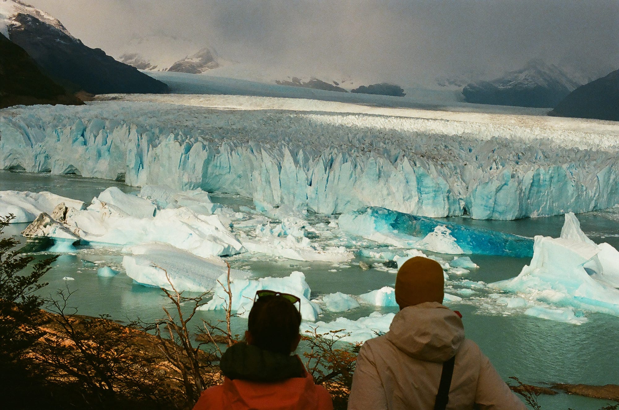
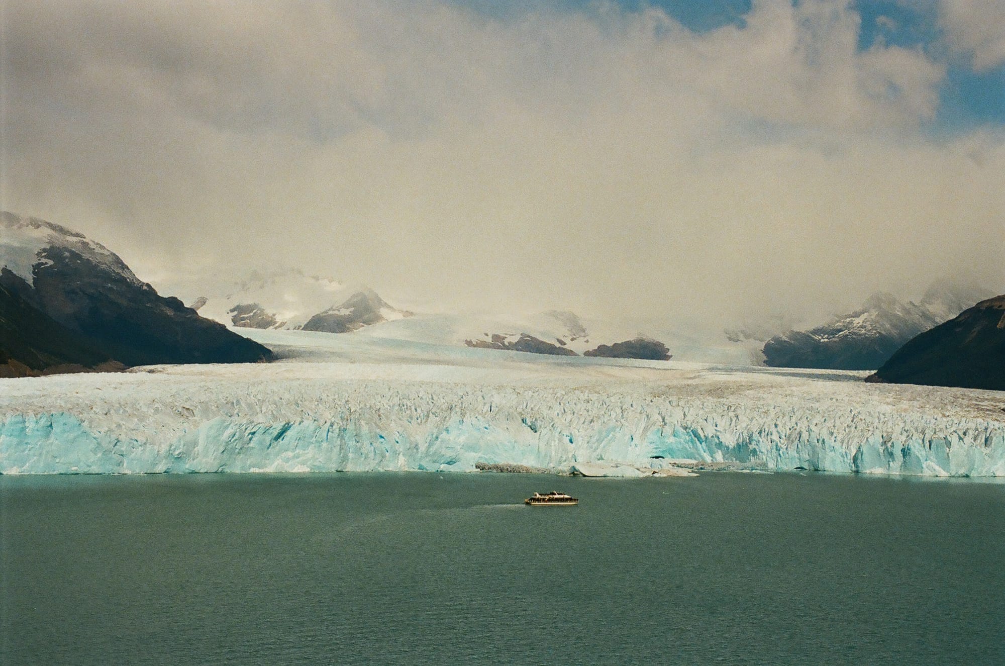
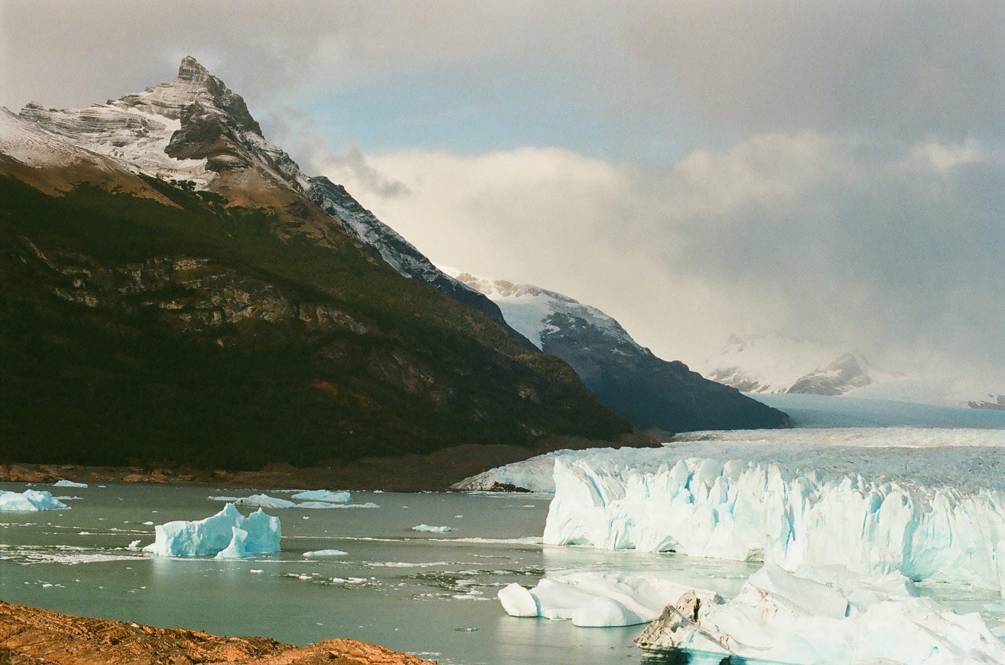
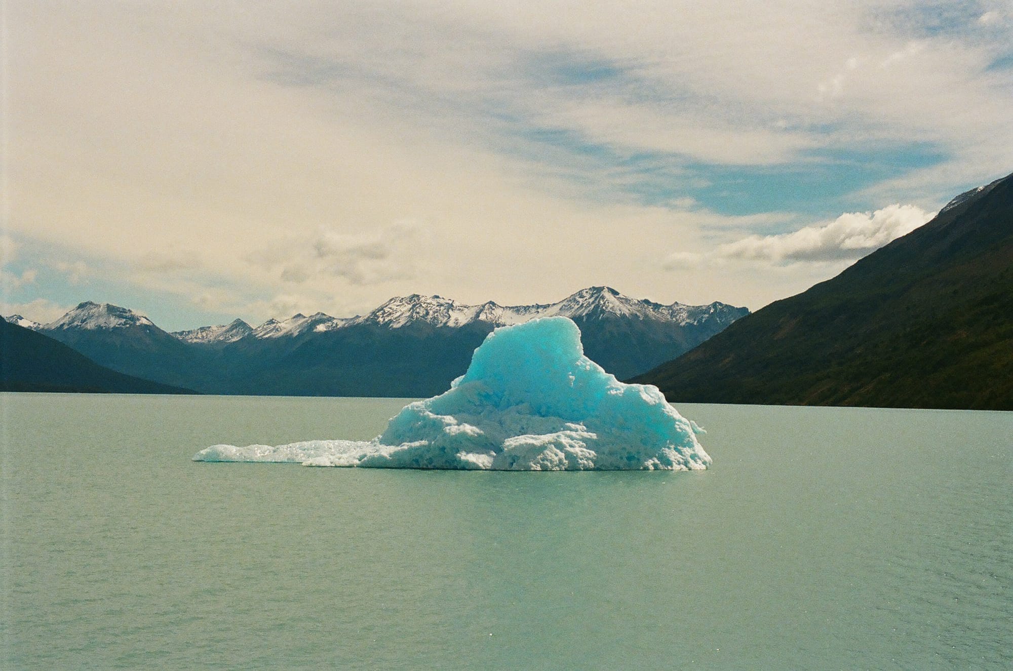
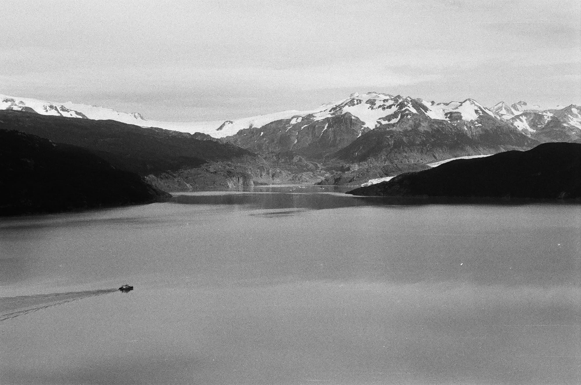
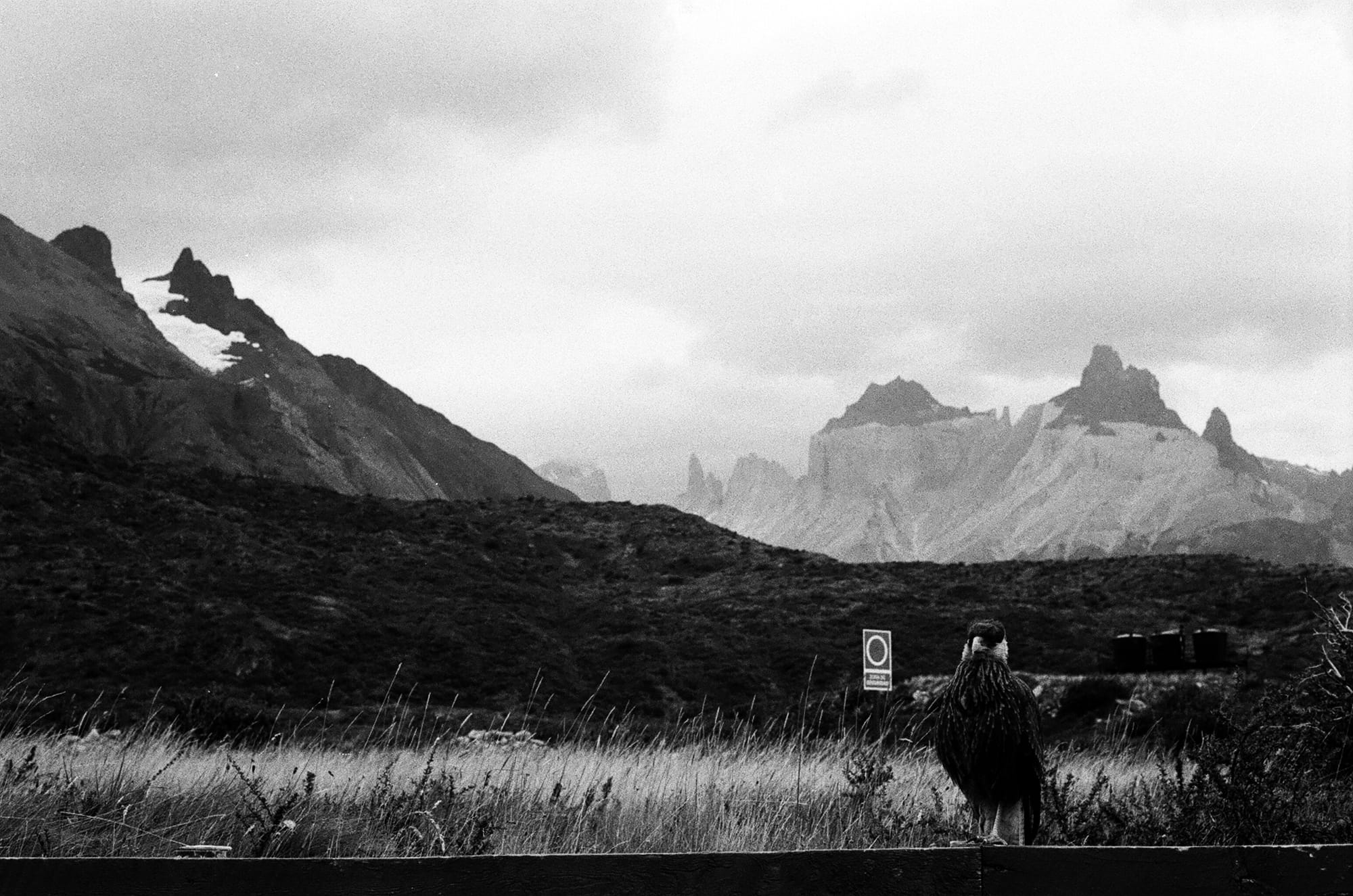
From Buenos Aires, we took a flight to El Calafate. It is basically a stop-over town on the way down to Patagonia but it is also the gateway to the Perito Moreno Glacier. We rented a car and drove to Los Glaciares National Park and were dumb struck by the sheer magnitude of the Perito Moreno Glacier. It is a 97 square-mile chunk of ice, over 500 feet thick. Rory thought he had a fun, happy fact that he learned on his last trip here that this was one of the rare glaciers in equilibrium and not retreating. Sadly, that has changed since 2023 and it is now retreating. Could it be due to the fact you can purchase a glass of whiskey with hand carved glacier ice from the gift shop? We can’t be sure. The glacier is calving often and we felt lucky to see quite a few large calving events. When ice falls off, the remaining wall reveals a deep indigo underbelly that lasts only a couple of hours before frosting over white. It is quite the spectacle and we spent the whole day on the walkways here, watching for calving and iceberg flipping and also the passing Andean Condor.
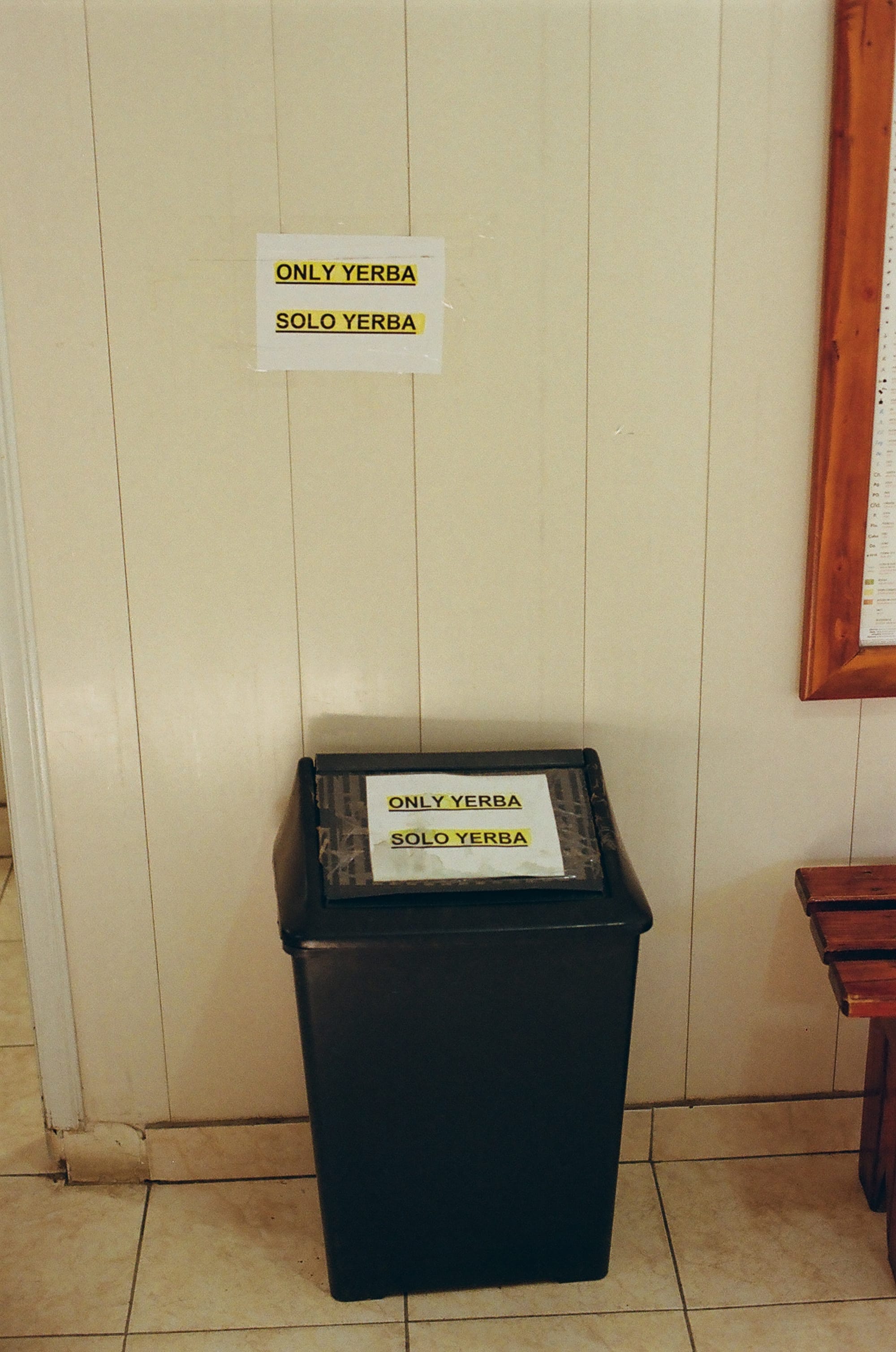
From El Calafate, we took a ride across the border to Puerto Natales, Chile. It was a bit of a cumbersome process doing this on a bus (paying the exit tax at the bus station proven only by a slip of paper the size of a postage stamp, a 7 hour bus ride, everyone off once to get stamped out of Argentina on a lonesome and dusty dirt road, and then everyone off again to get stamped into Chile a half mile down the same dirt road.) The real highlight of the bus day was the volume of sweet stray dogs that seemed to have mapped out all the stops along this well-traveled route. From the time we started at the El Calafate bus station at 5 am, the dogs were already inside the terminal, waiting eagerly to make new friends and get their favorite snacks from the vendors. They were at every bathroom and snack stop, patiently waiting for pets and scraps. This may be a good place to plug Argentina and Chile as the most dog-loving countries that we’ve ever been to. We saw hundreds of dogs here and nearly all of them seemed friendly, happy, and, quite honestly, fat. The only thing that Argentinians seemed to love more than their dogs is their Yerba Matè.
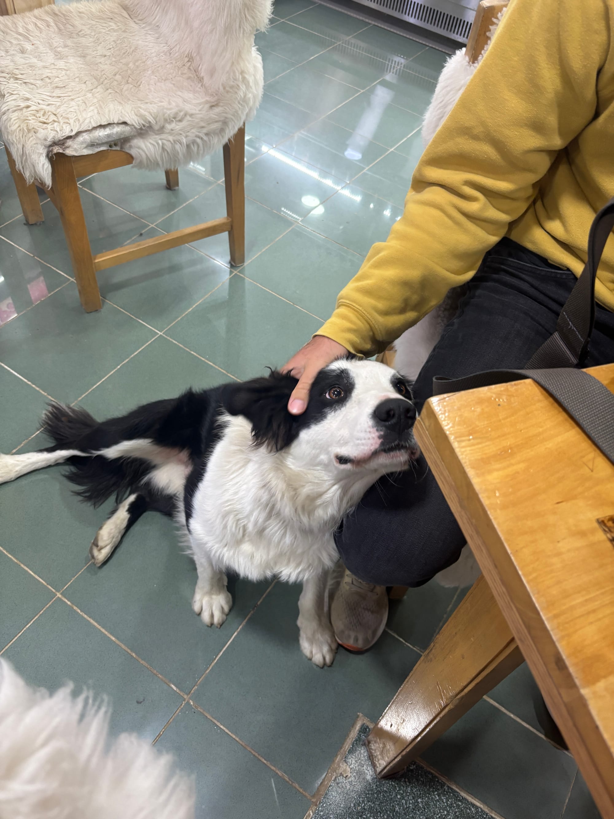
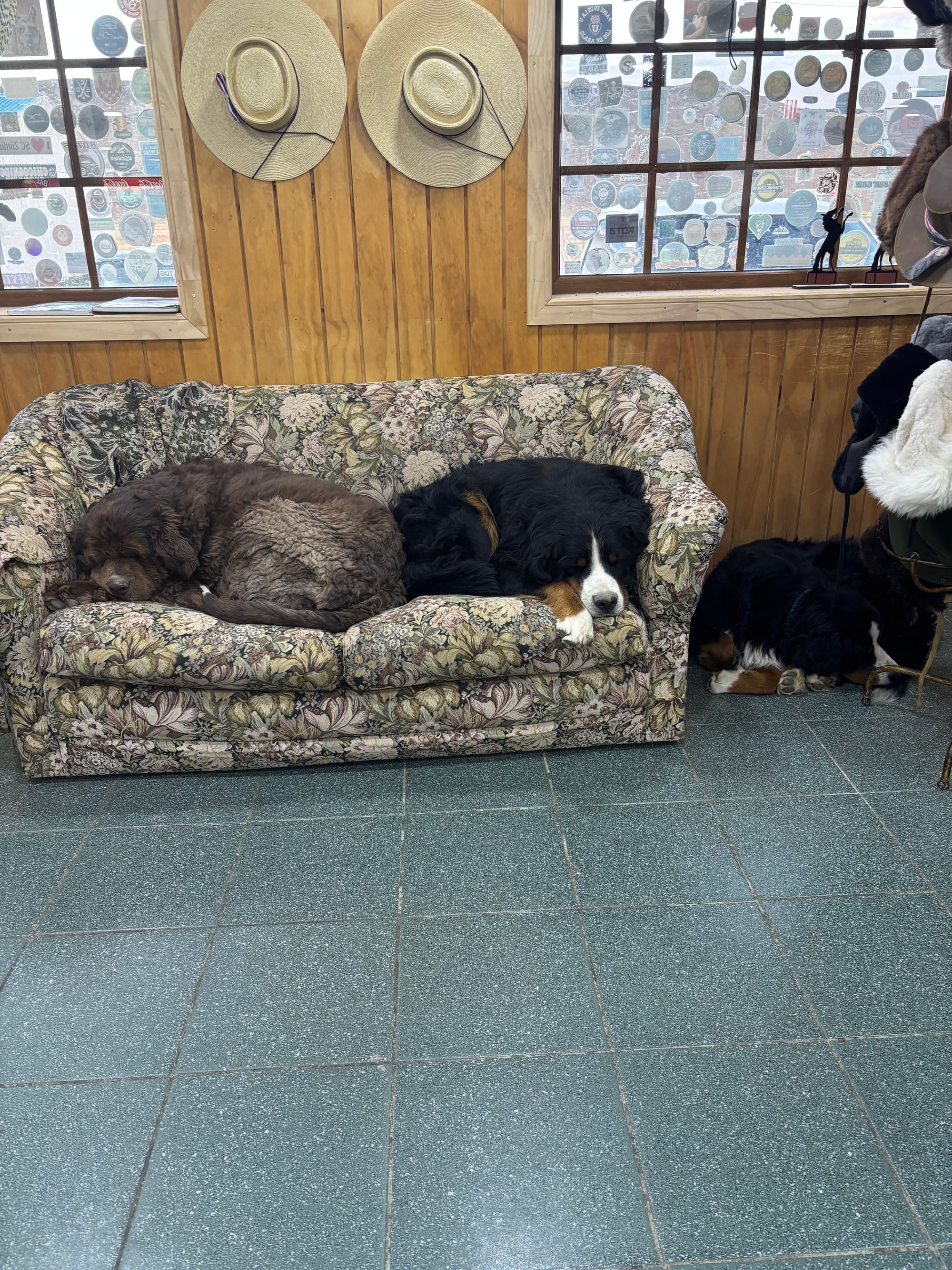
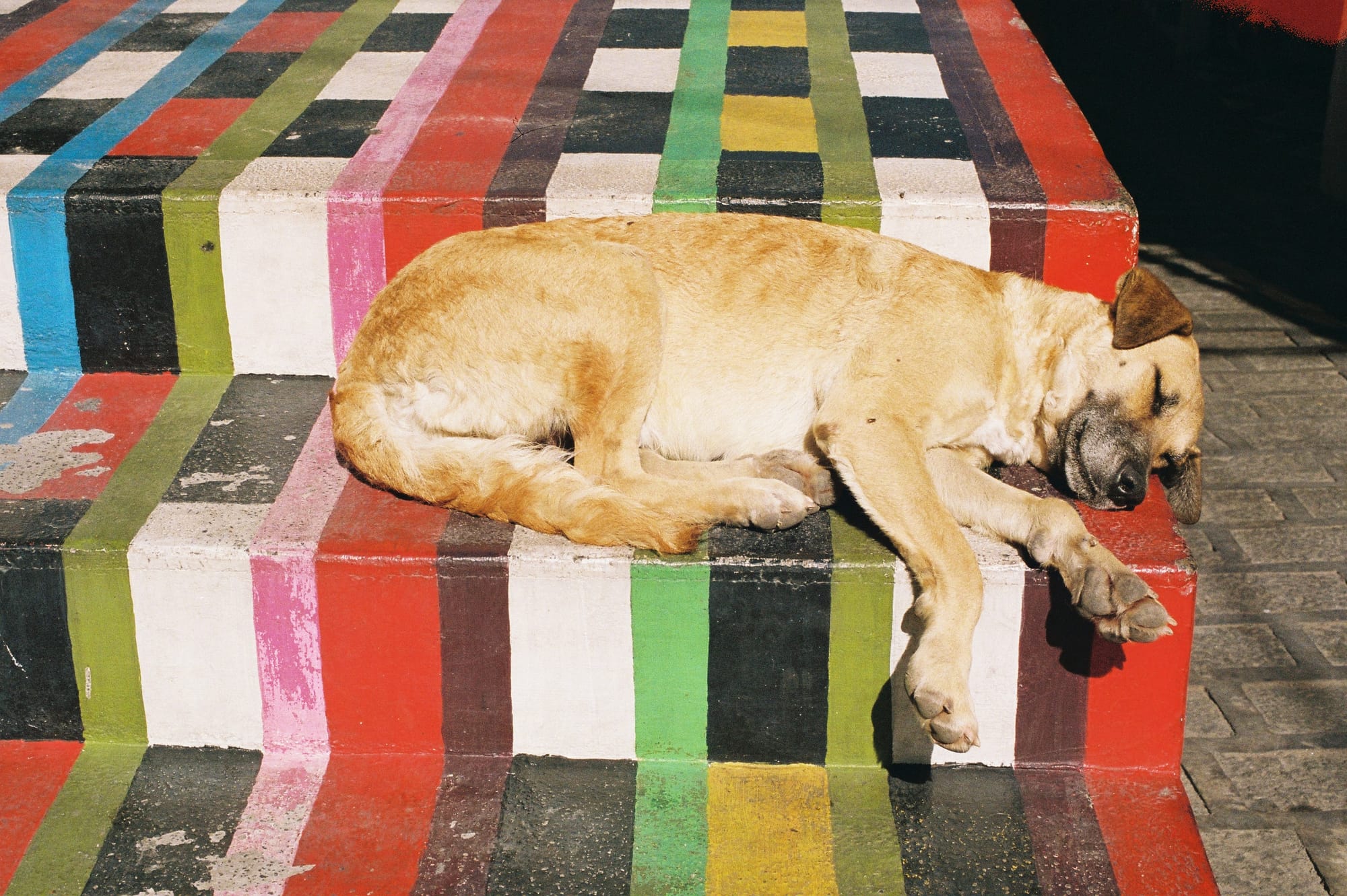
The many pups of Patagonia
Still, we had another early 2 hour bus ride to the Torres del Paine park entrance, then a shuttle to the trailhead. It really was an entire trek just to make it to the trek. People don’t just stroll up to this National Park, which we think makes it more special. The highlight from this bus was ride was spotting a puma from the bus just as we entered into the park! (Pardon the video slightly below 4k quality…)
Puma sighting from the bus at the entrance of Torres del Paine National Park
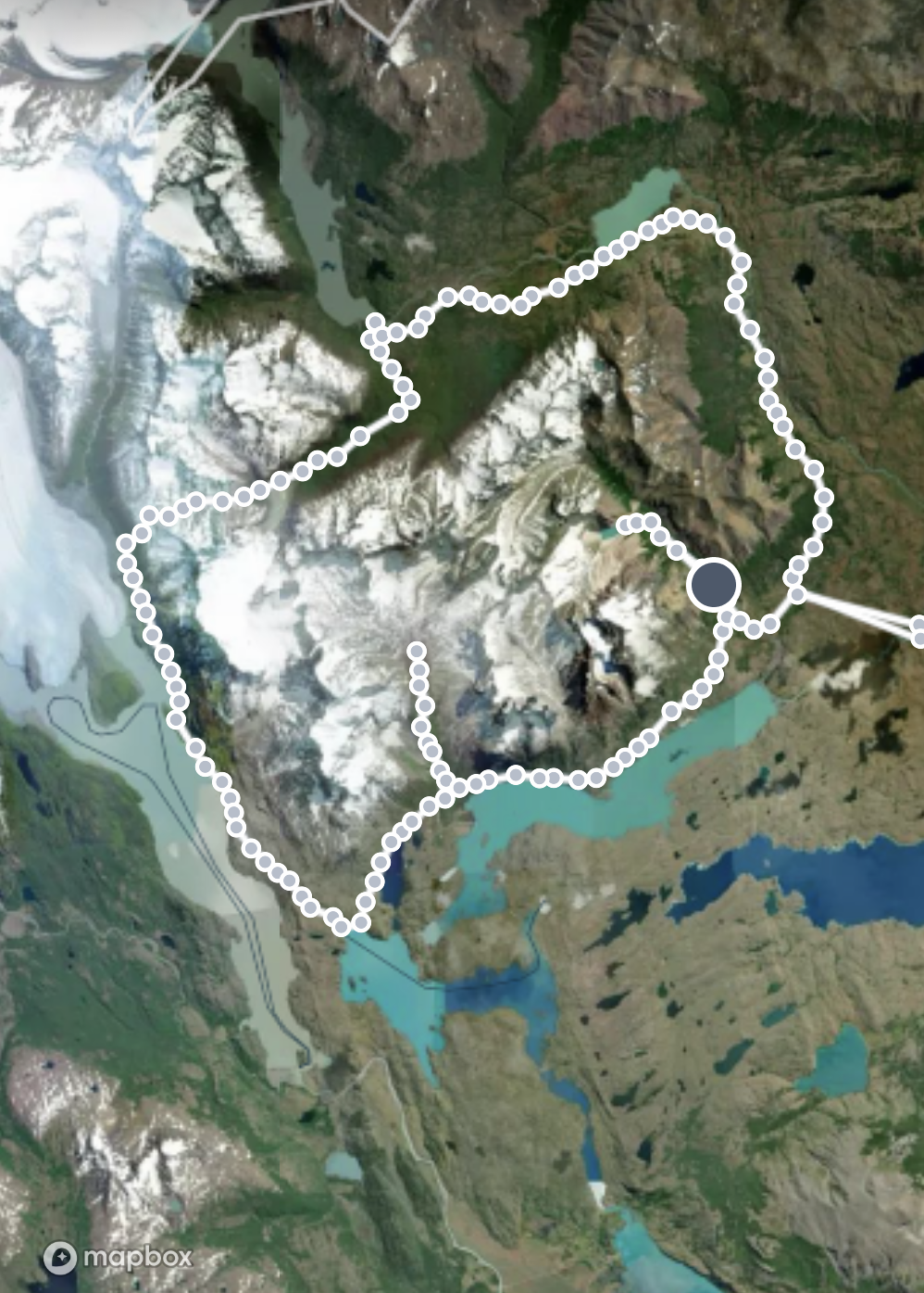
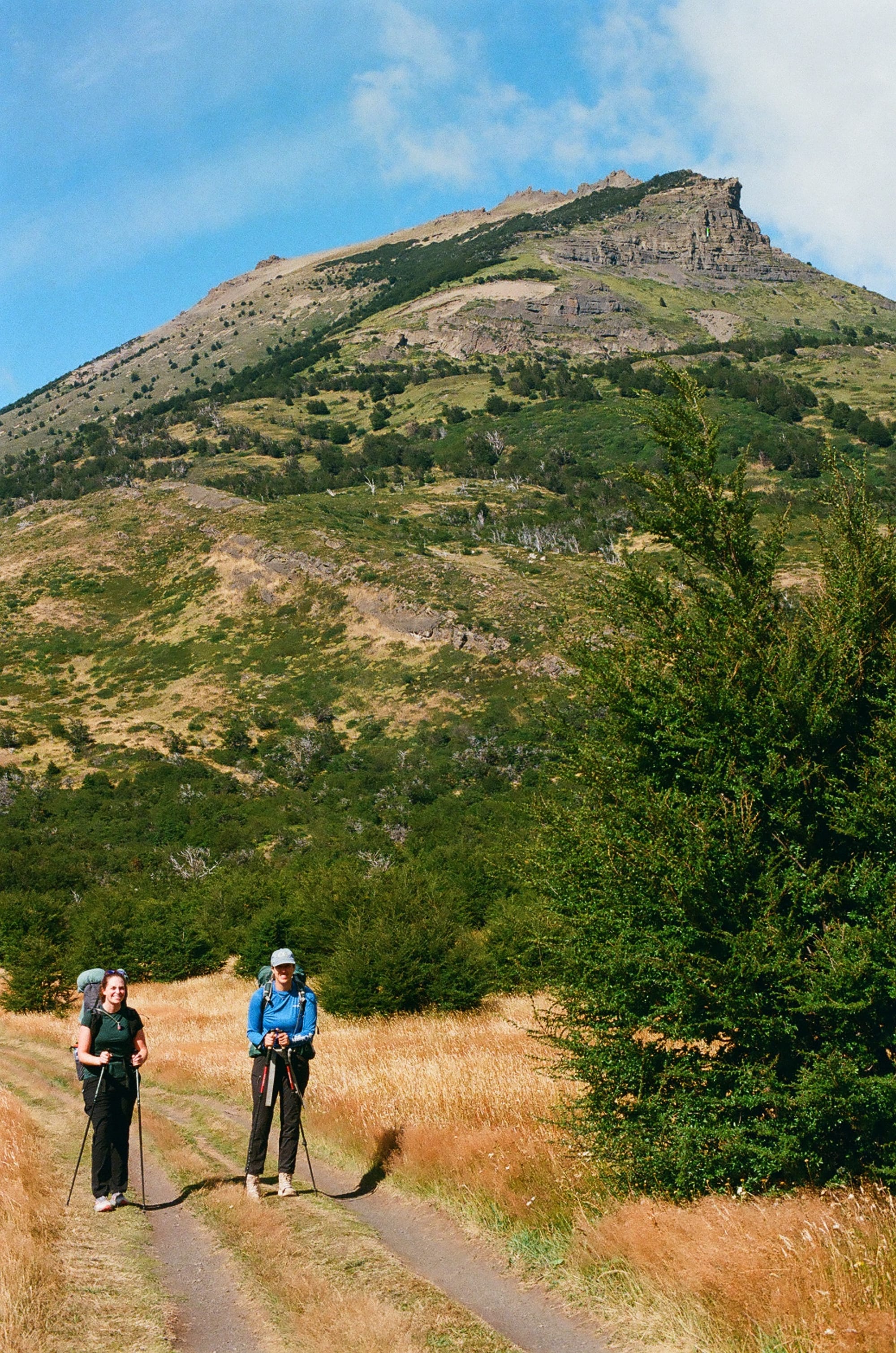
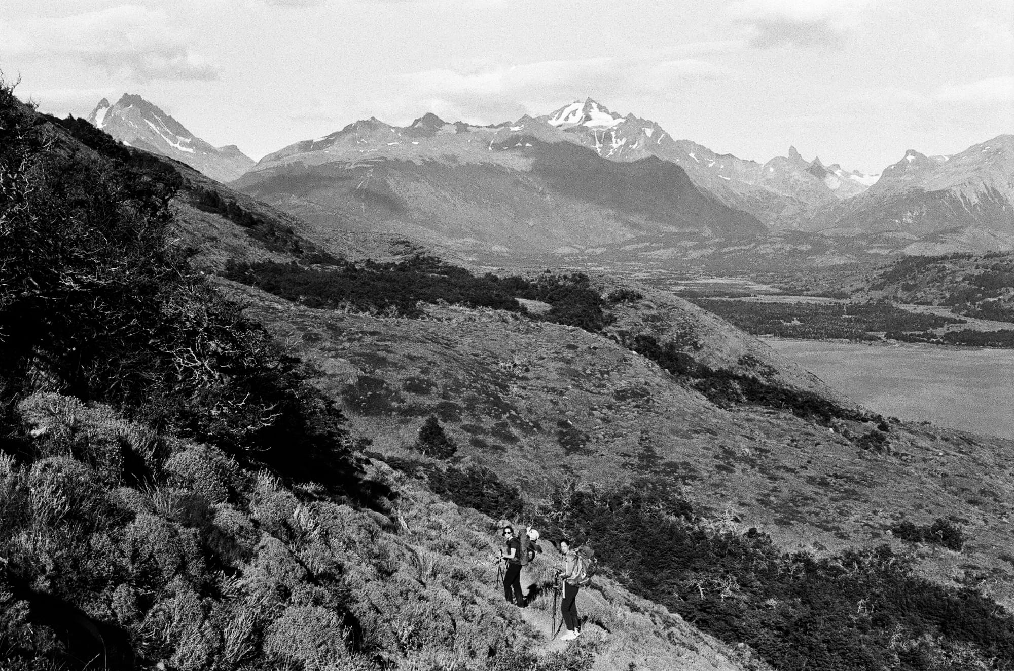
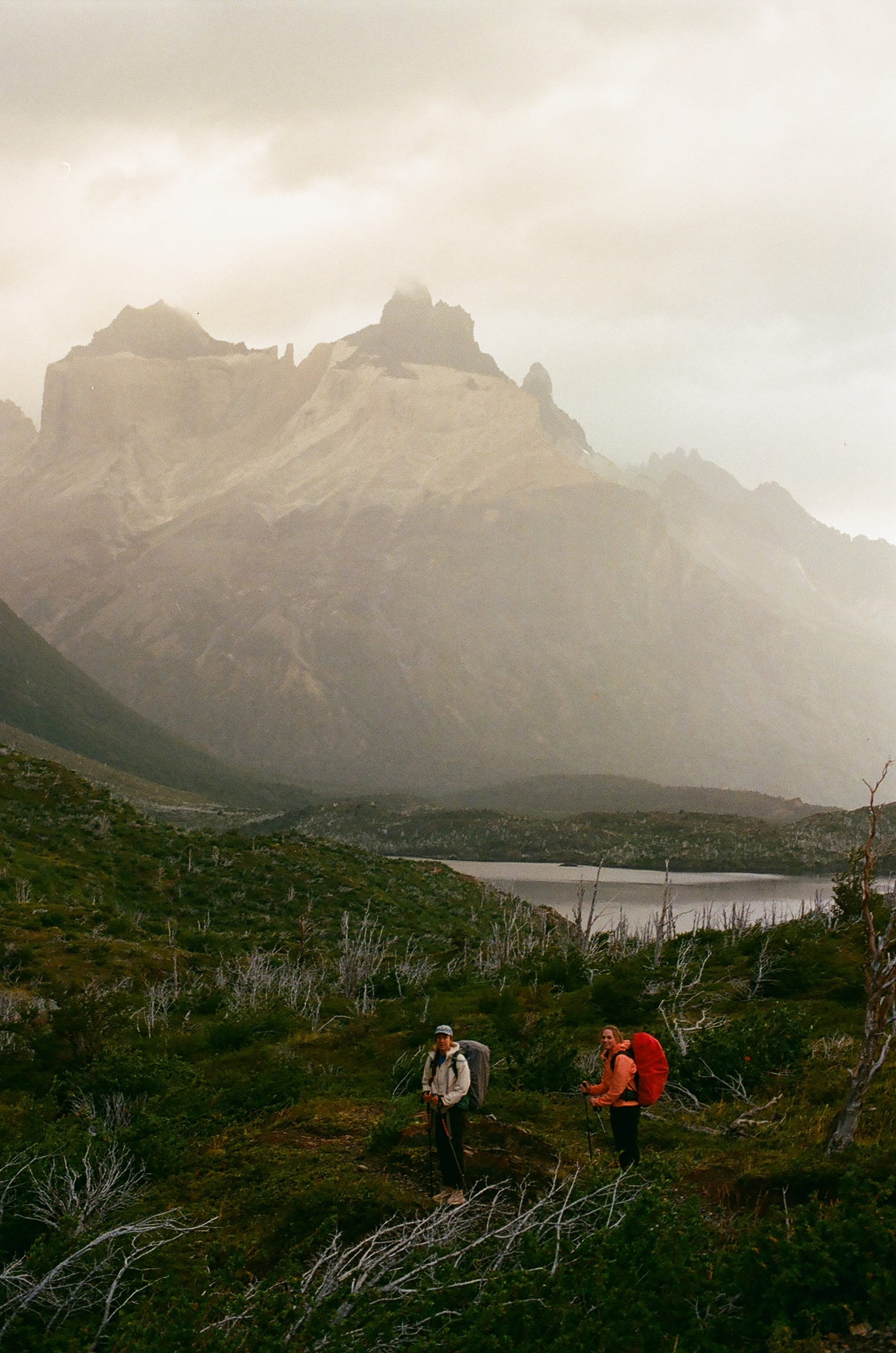
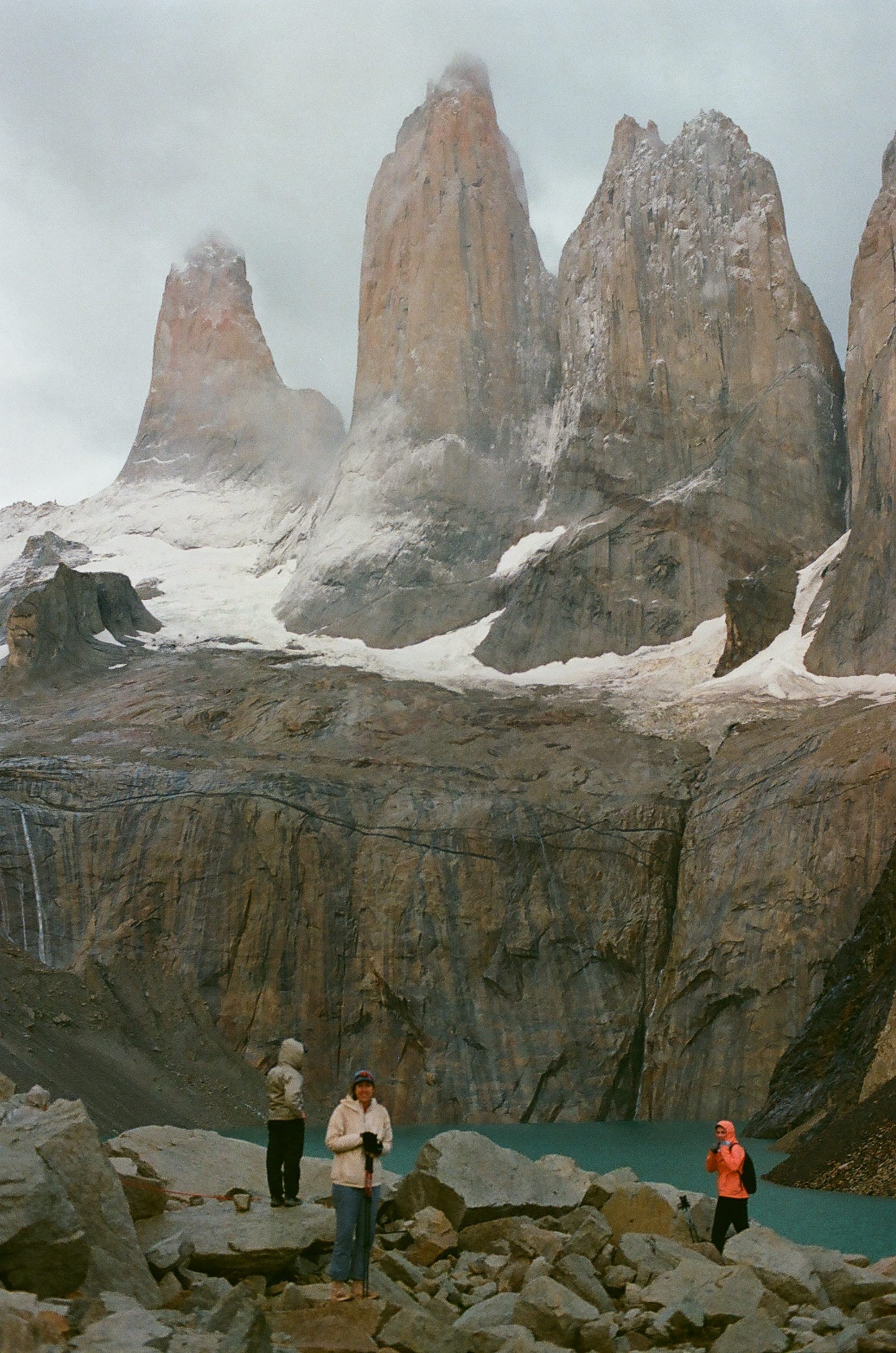
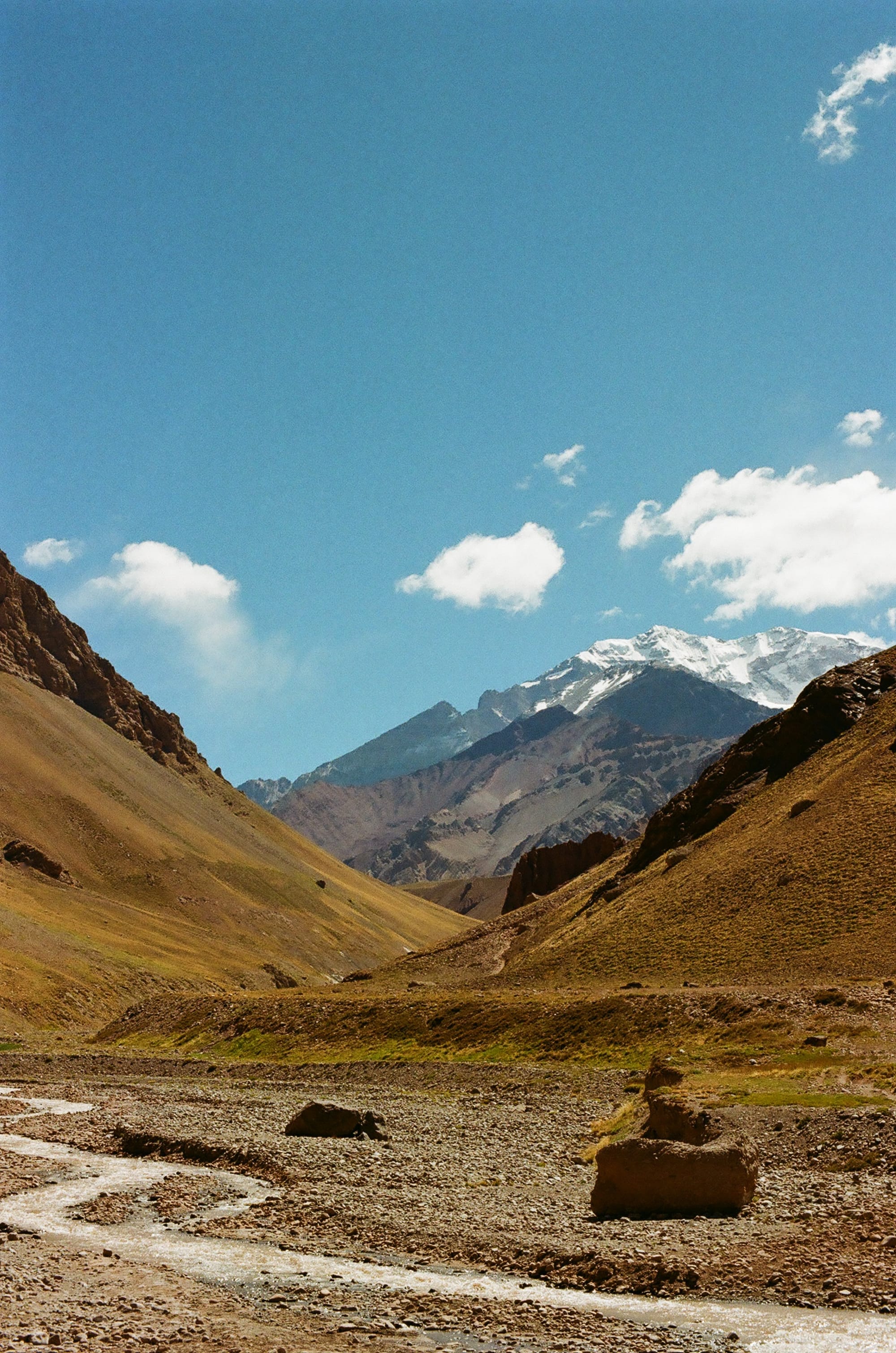
The O-trek is a 75-mile loop through Torres del Paine national park with roughly 17,000 feet of total elevation gain. It must be walked counter clockwise without skipping camps but it can be done on different levels and budgets. For instance, you can literally sleep in a yurt every night and be fed three hot meals a day so the only thing you have to carry is water and clothing. But, that can run you like $15,000 per person. So, we opted for the most affordable (also hardest to book) option of carrying all of our food and clothing and gear and sleeping in our own tent every night. But believe me, we really did enjoy the backcountry amenities even for campers. There were showers (some even hot!) in most campsites, along with beers from the kitchen. It was a shock to see these well-equipped campsites in the middle of nowhere and something that we had never experienced before while backpacking.
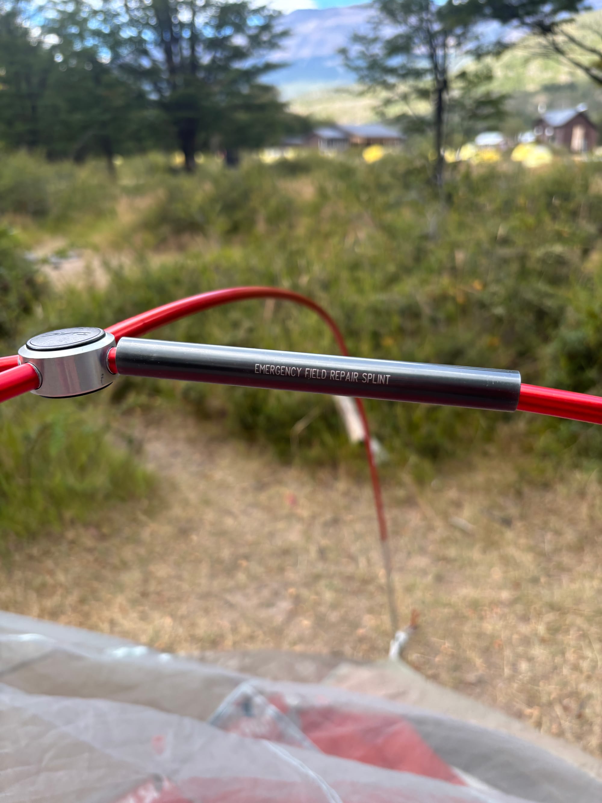
Our first day was quite easy and we were grateful for that with our packs being the heaviest they would ever be on the trail. It was about 8.5 miles over some rolling hills heading NE from the trailhead as we started counter-clockwise on the loop to Seron, the first campground. Now, for our friend Alyssa, this was a last minute trip so she booked campsites only 9 days before flying out and she was very lucky to get nearly all of the same sites as us. But, there was no BYO tent option at this campsite so she paid for an elevated yurt which looked quite nice. And sturdy. It was incredibly windy in Seron with gusts up to about 50 mph. We thought we were pretty clever and pitched our tent directly under Alyssa’s elevated yurt and tied down our tent and rain fly with guy lines to her metal foundation. But at 2 am we were woken up by big wind gust and then a loud crack and a partially collapsed tent wall. One of our tent poles had snapped in half. We wrestled with our tent in the wind and luckily had packed a tent pole splint which we slid on and reassembled everything. We kept the fly off for the rest of the night as it was acting like a main sheet on a sailboat. With every big gust, we held our breath but we made it to sunrise without further trauma. Meanwhile, Alyssa slept soundly through the scene that was unfolding not but 2 feet below her. It was an unfortunate first night as we now were looking down the barrel of 6 more nights in the backcountry with a busted tent and no idea of how protected our upcoming campsites were. But, the good news was that the splint held so we ventured onward. The bad news was we were now known as those poor fuckers whose tent broke and flew away on night 1.
Our second day was about 12 miles to Dickson campground. We turned northwest and had sweeping views of the huge Lago Paine to the right and views of the north faces of the snow-covered peaks to our left. We walked directly towards the massive distant glacier almost directly west following the Rio Paine nearly the whole way. As we descended to camp that afternoon, we saw the picturesque grounds right along the bank of Lago Dickson. We were rudely reminded to keep moving and not gawk at the scenery by one of the largest and hungriest clouds of mosquitoes that we have experienced to date. This was our first camp shower and what a revelation it was. That, and the 2-for-1 glasses of Malbec, really rallied our spirits. We also began to feel some camaraderie with our fellow hikers as we realized that they would be the same faces around us for the next week as we headed the same way over mountains and valleys.
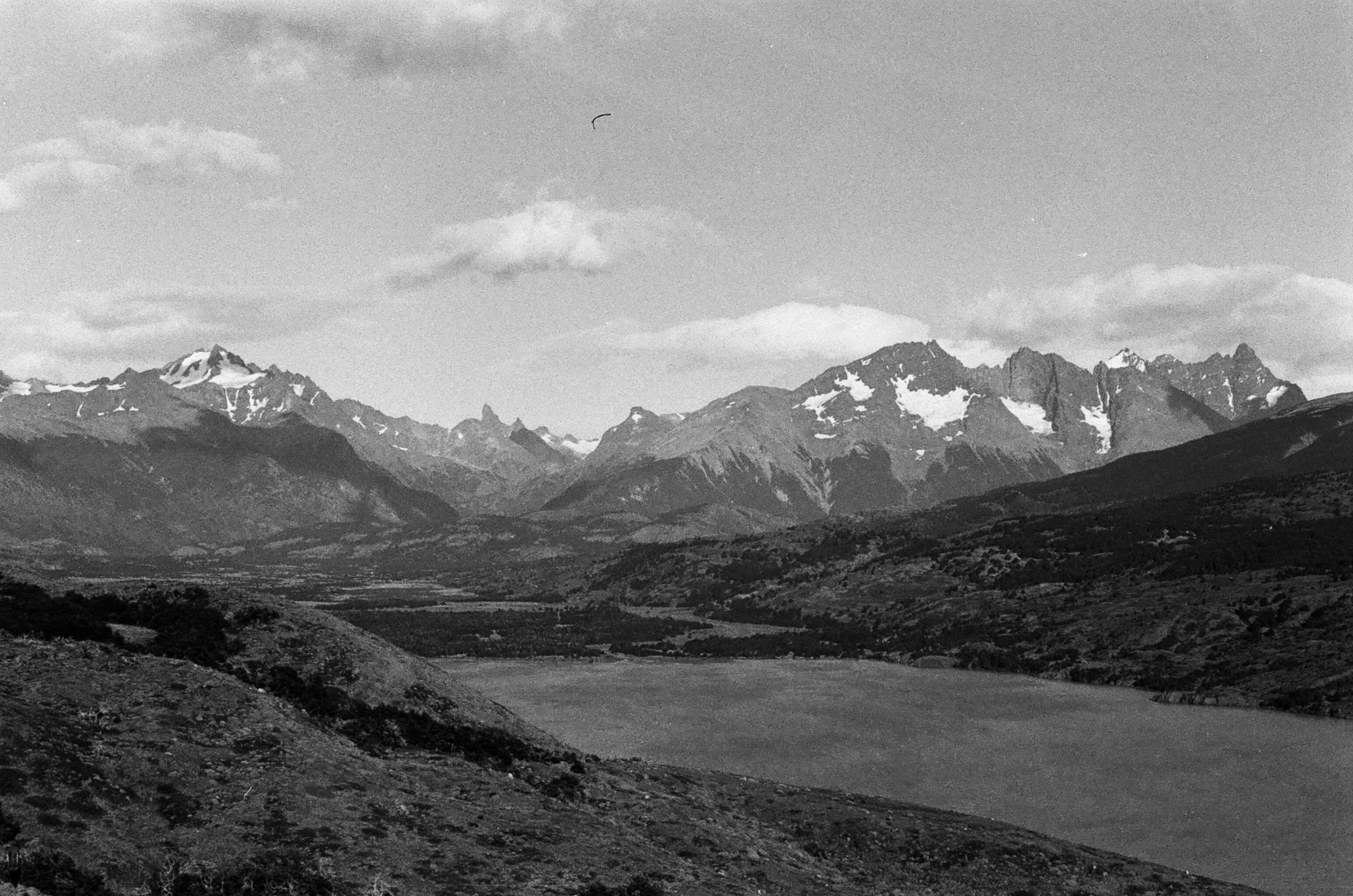
Luckily, the tent splint seemed to be doing its job as we woke up in an intact tent. Our third day was shorter, about 8 miles, but the forecast was a bit grim. We had a climb west out of the valley and the first 6 miles or so were reasonably protected in forest. However, as we exited the trees and continued our ascent, our last 2 miles were very exposed and we were pelted by rain, hail, and wind. This was our first chance at a close glimpse of Glacier Perros as it seemed to melt into a turquoise pool. We entered into Los Perros campground cold and wet, and unfortunately would stay that way for the rest of the night as there were no showers or much shelter here. It was a cold night and we were a bit nervous for tomorrow, which would be the hardest and most technical day over John Gardner pass. But, the weather forecast from the rangers sounded promising though this was hard to believe as we fell asleep to the soothing sound of hail on our tent roof…
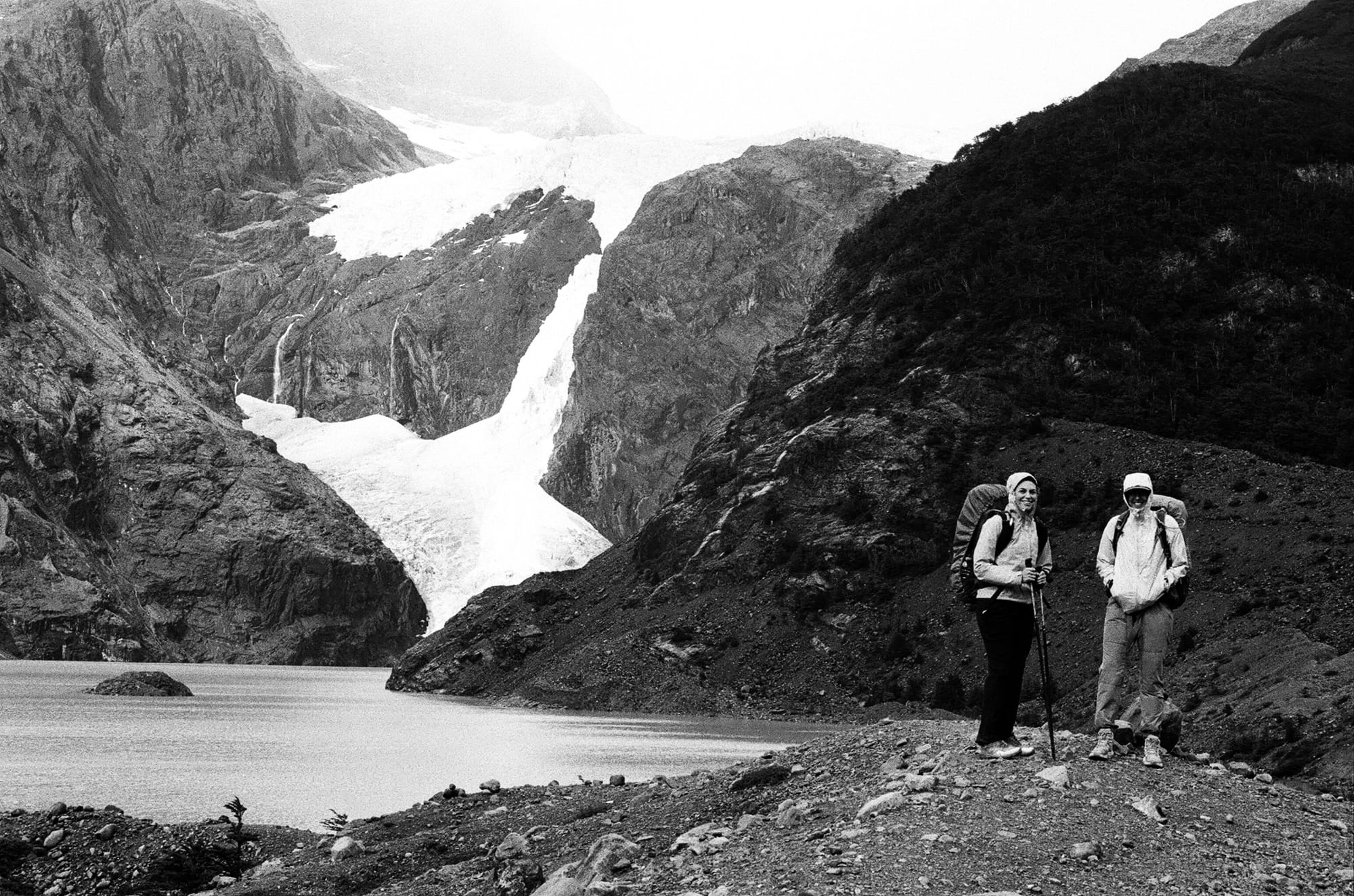
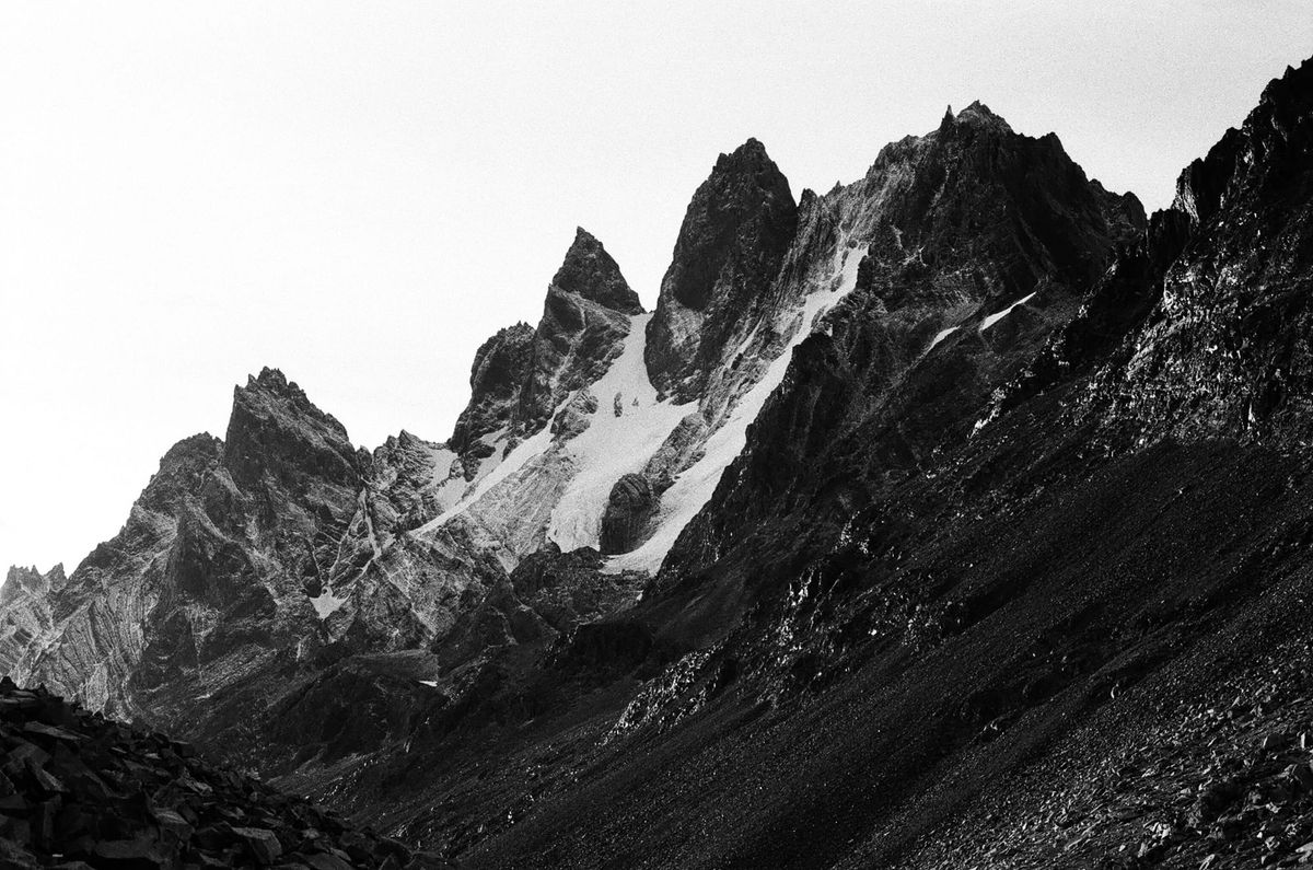
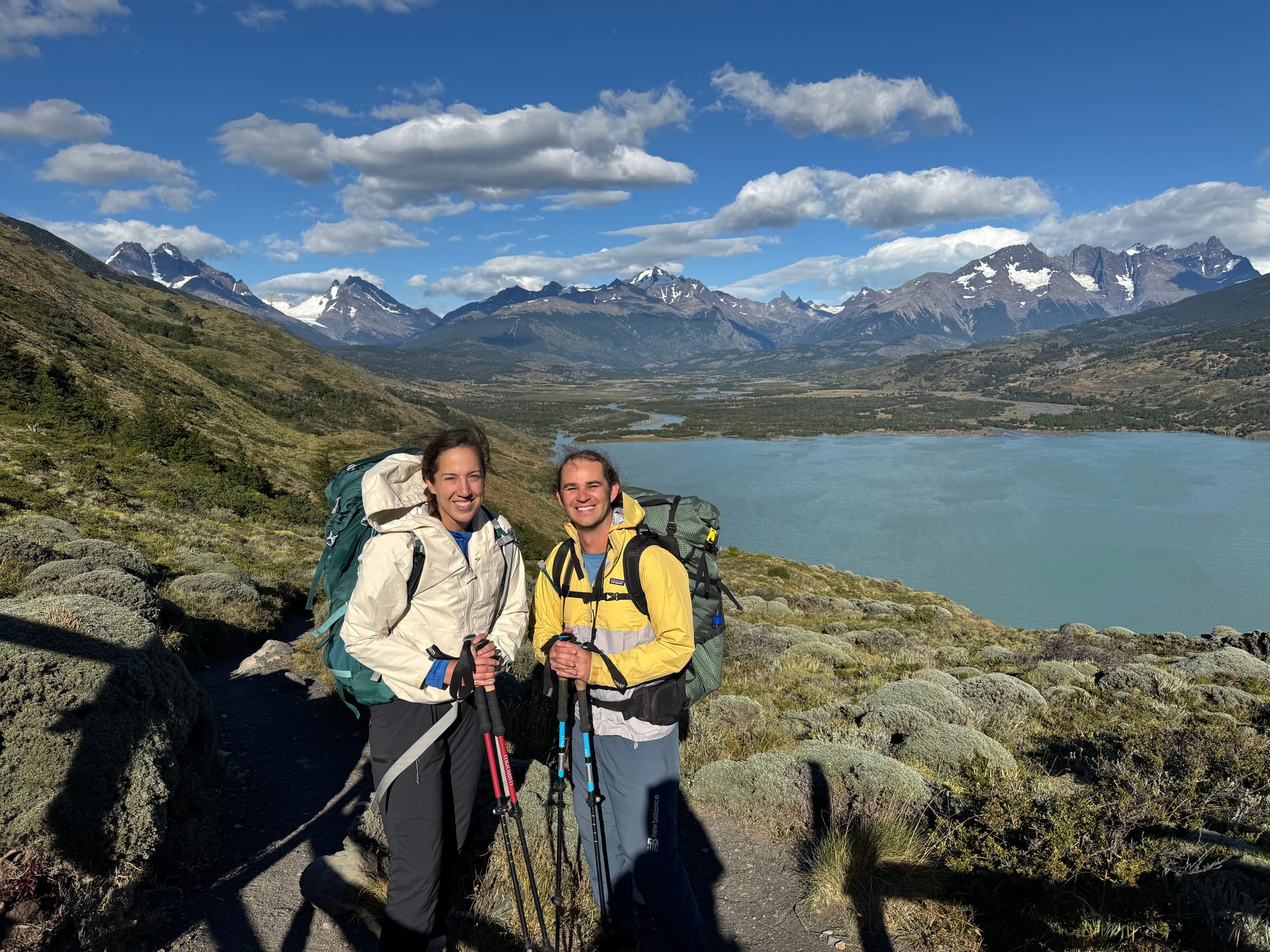
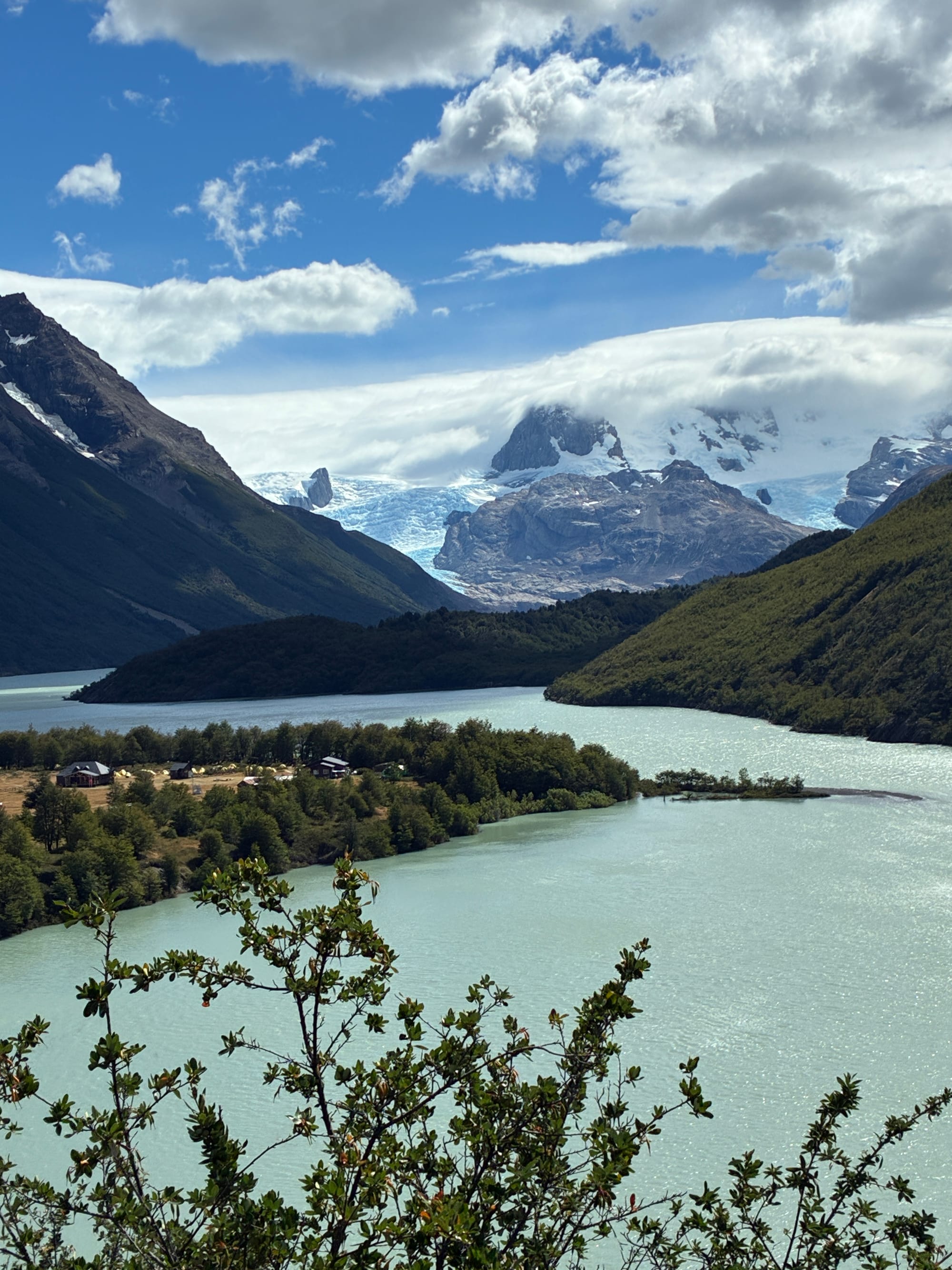
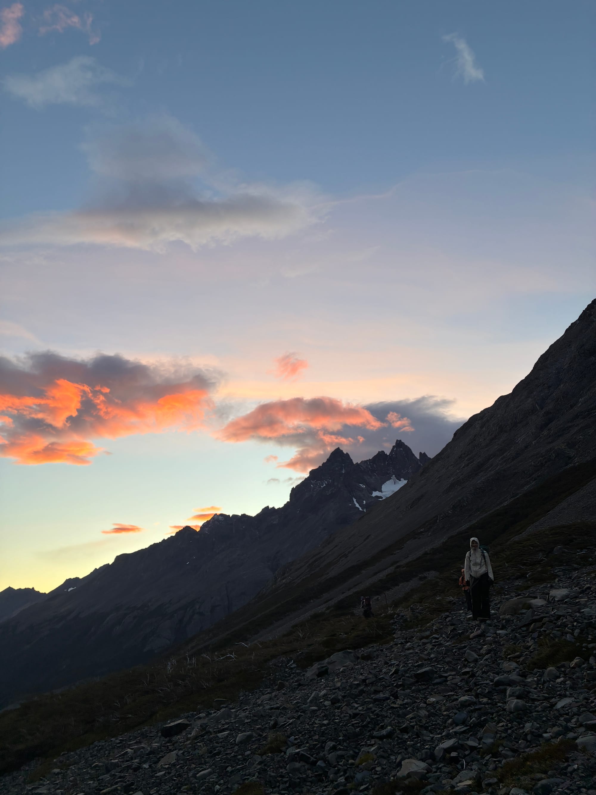
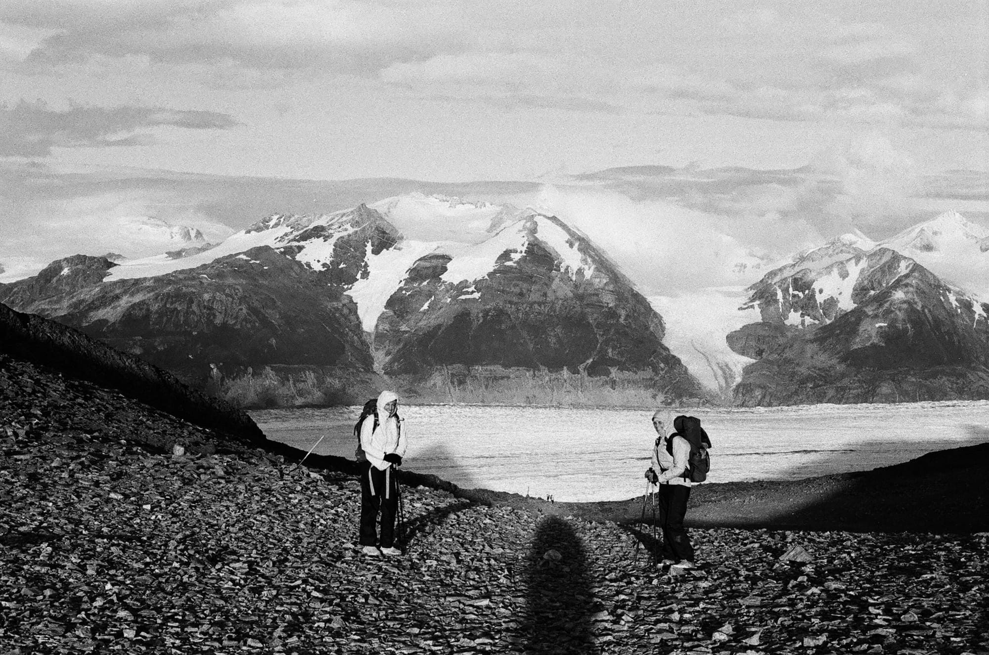
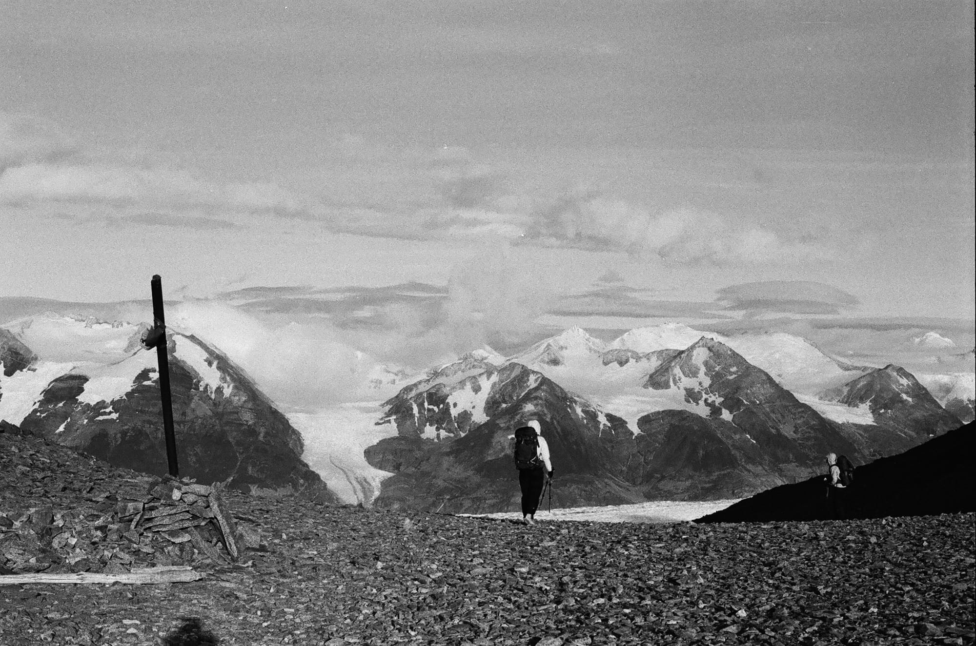
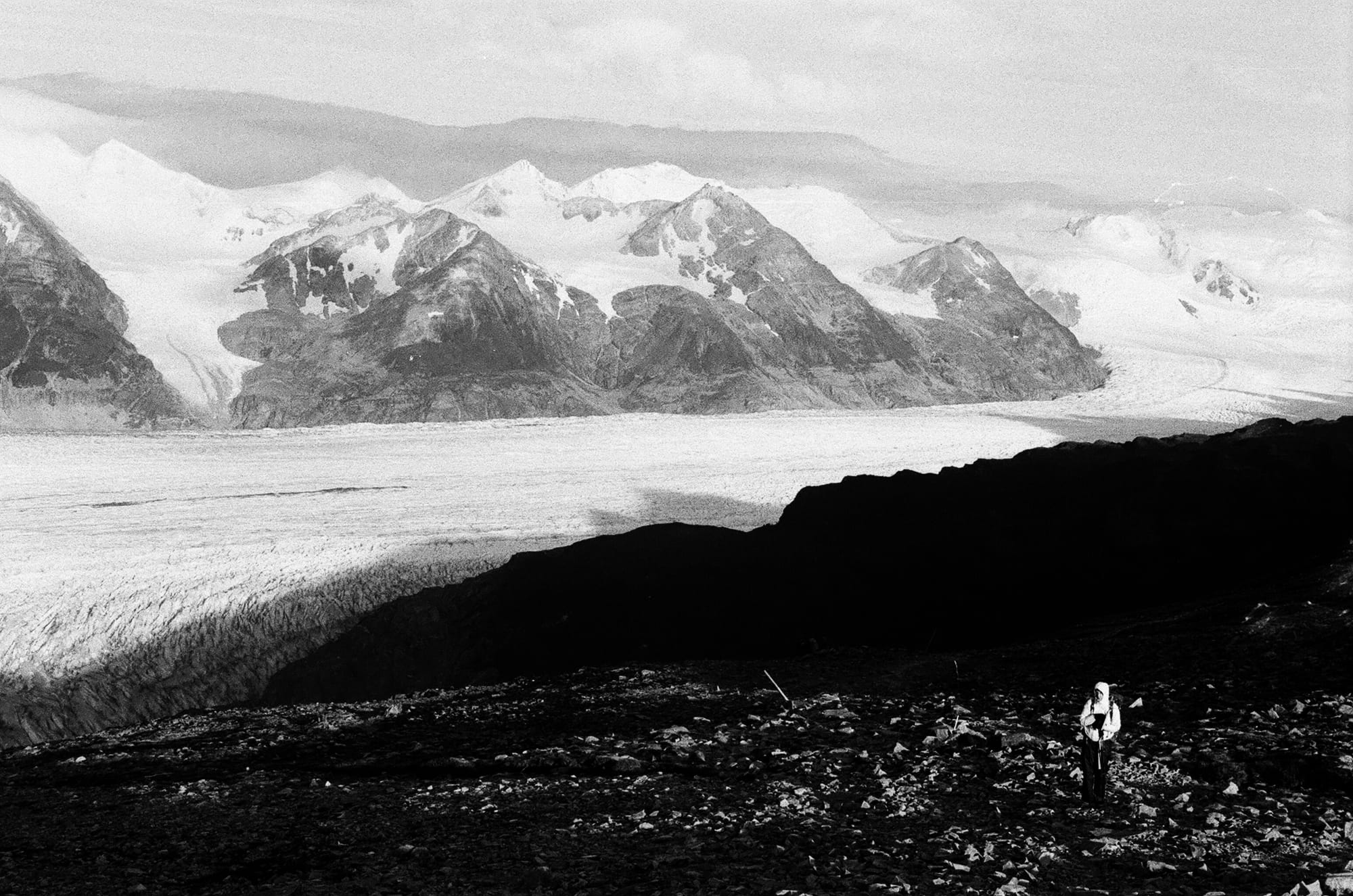
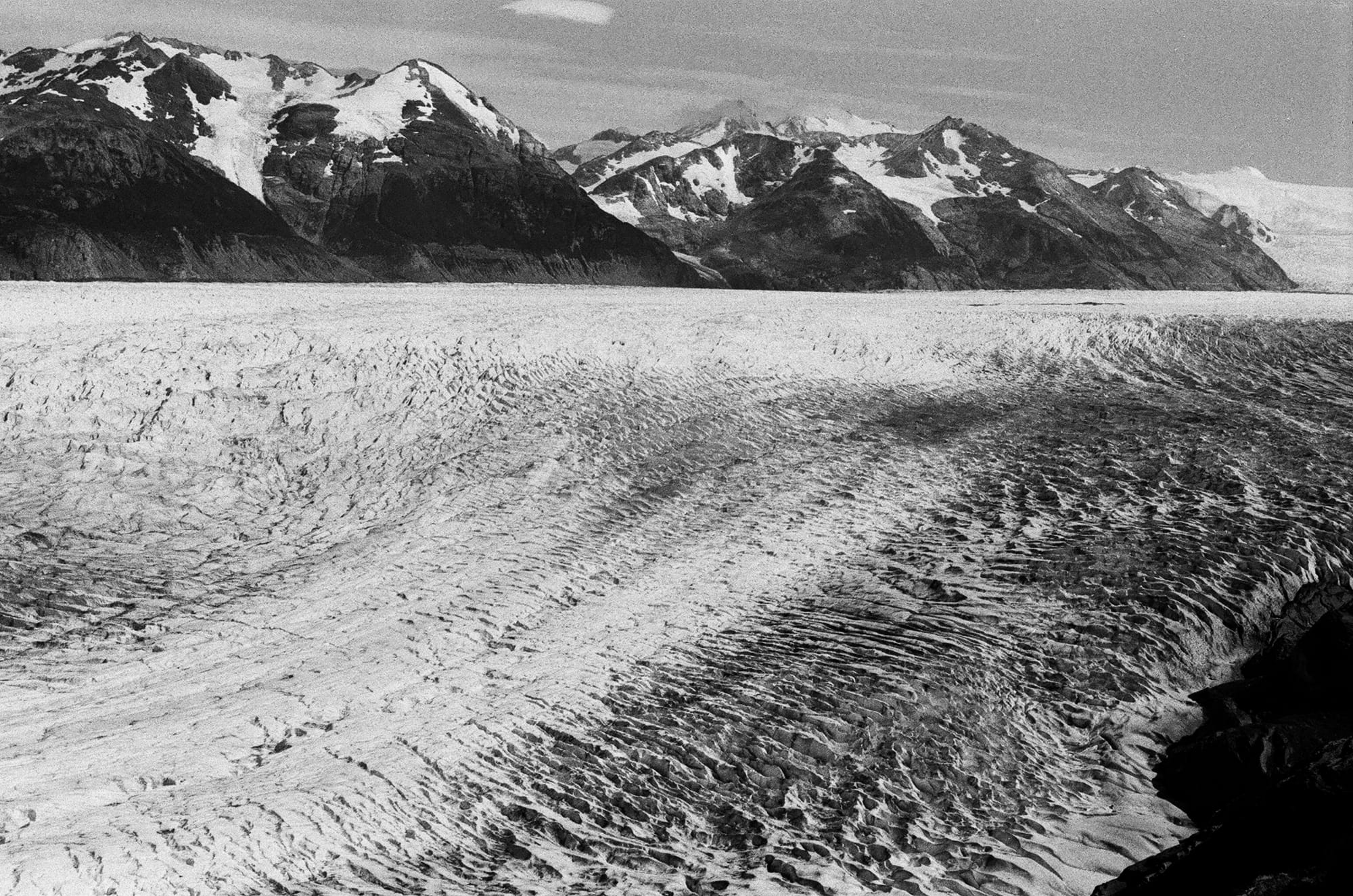
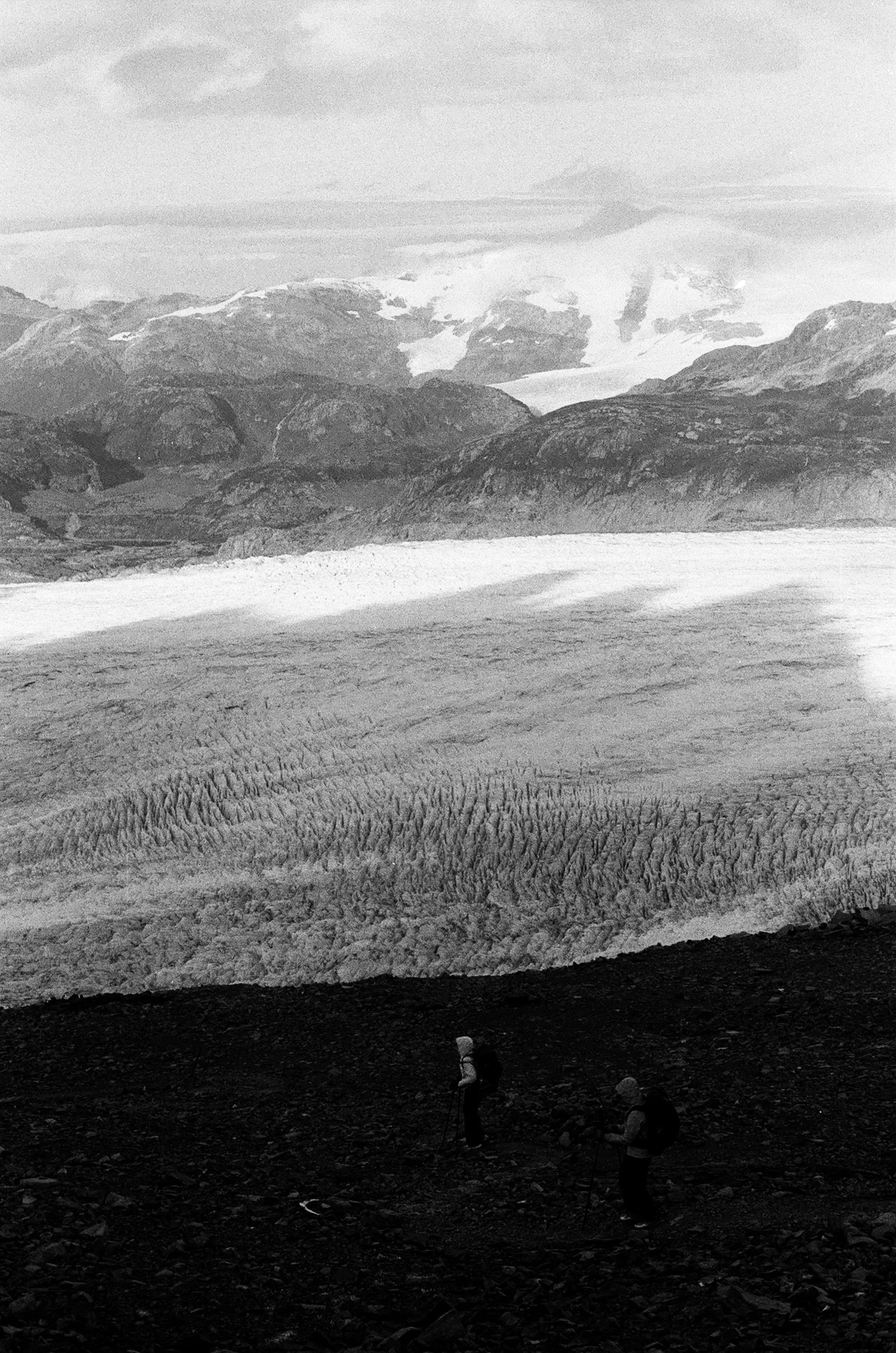
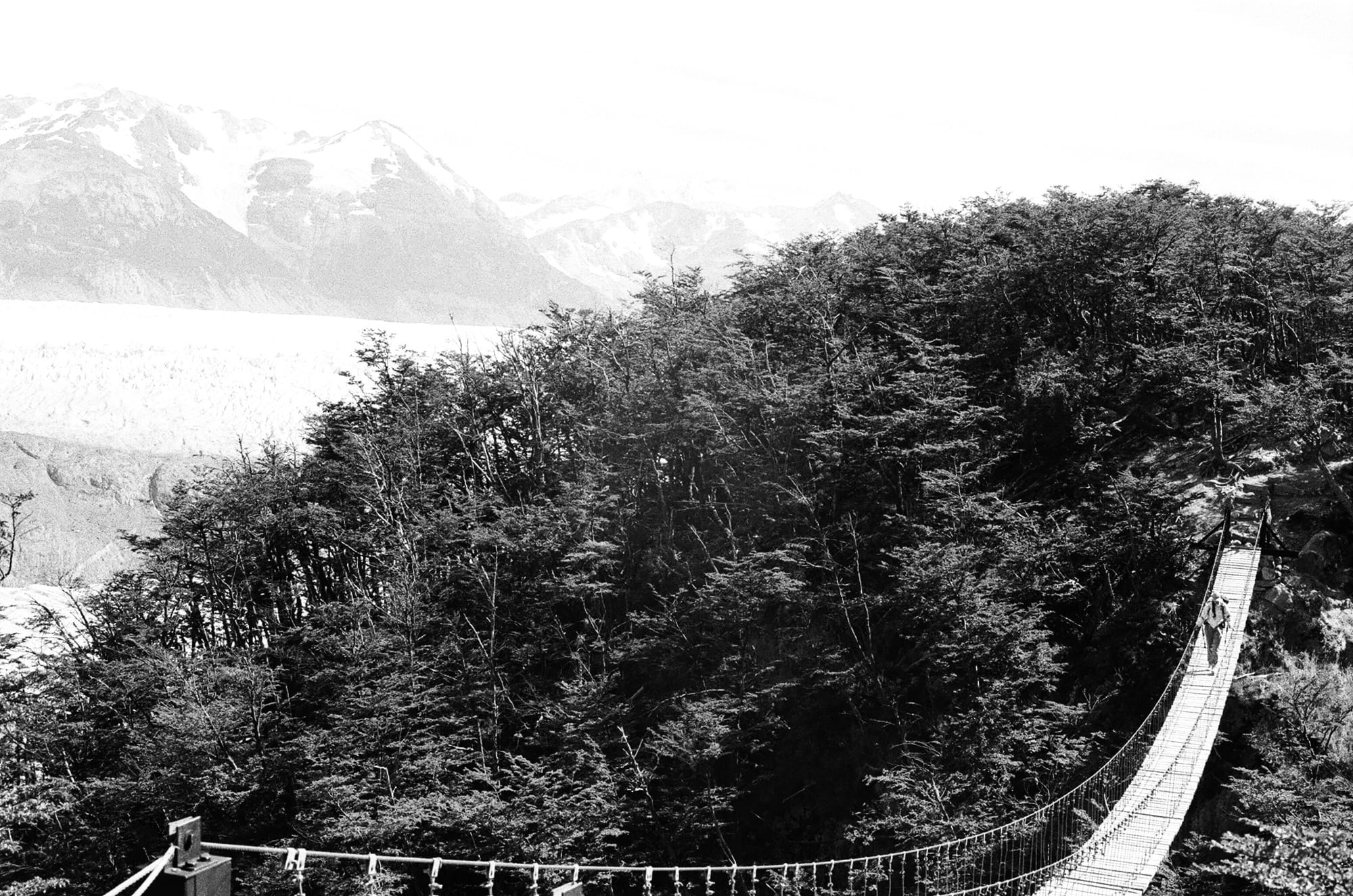
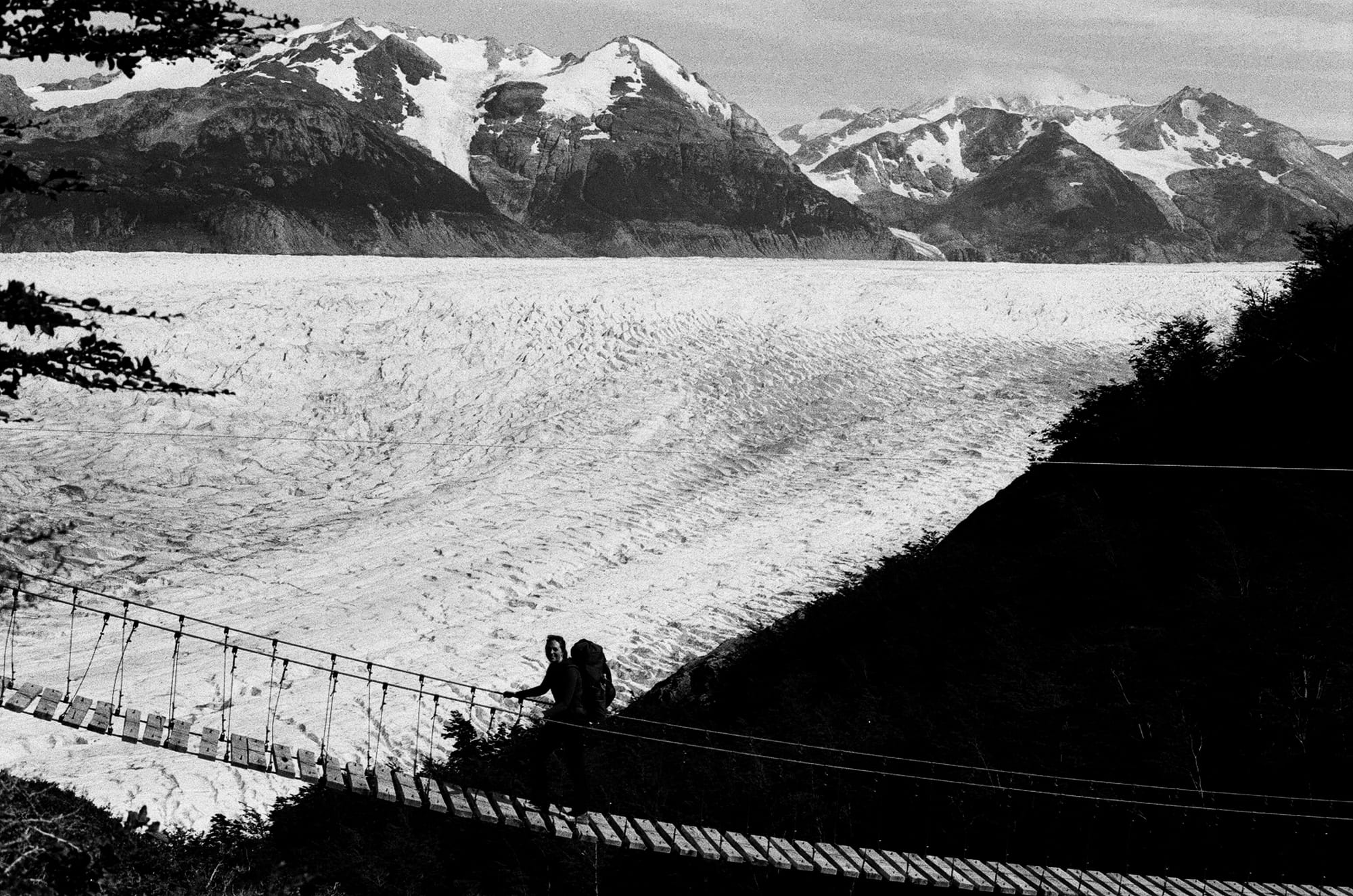
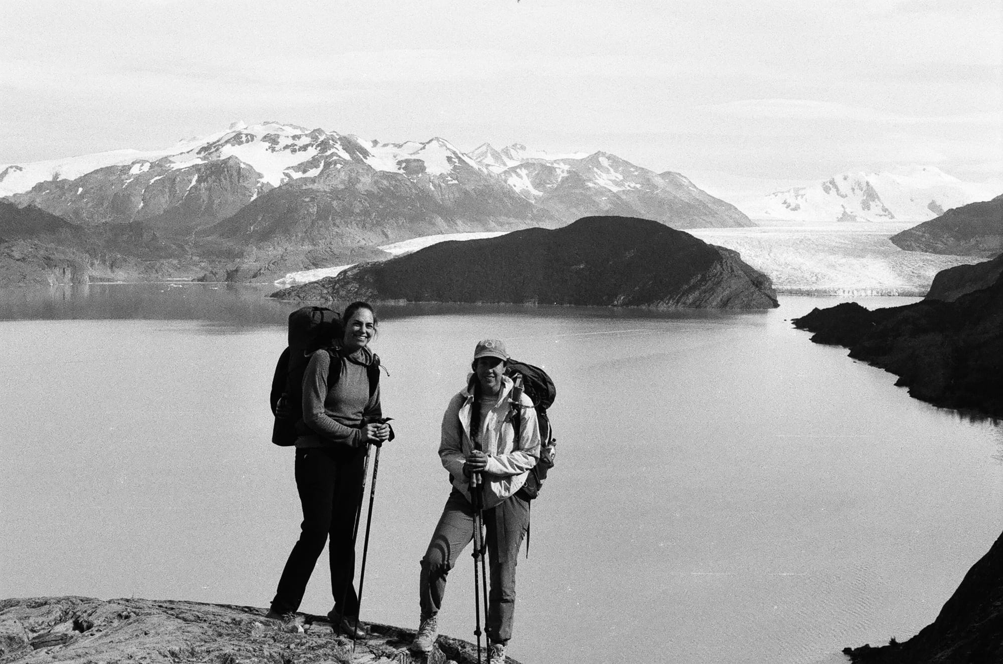
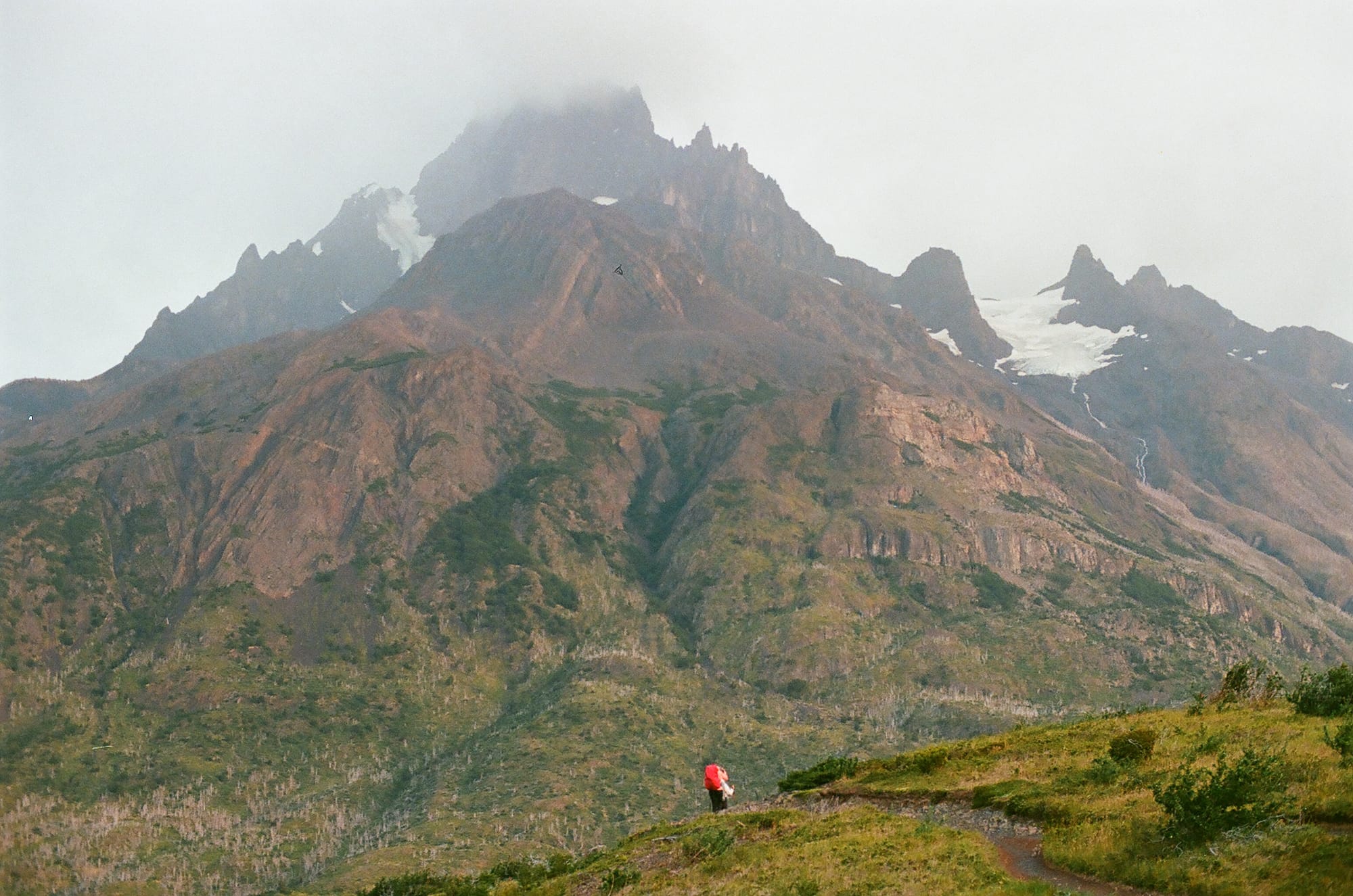
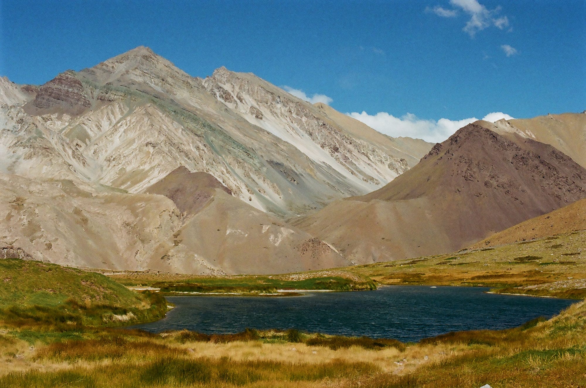
John Garner Pass is not one that should be taken lightly. Weather can change quickly and it is so exposed that if there is enough wind (commonly over 80 mph) or a blizzard it can be impassable. A few months before our trek, we read about 5 people who died on this pass from hypothermia after getting caught in a storm. In that circumstance, it was compounding bad luck that led to their deaths. In Chile, voting is mandatory and there are fines if you do not vote. In November, on Election Day, the rangers from Torres del Paine all took the day off so that they could vote and not be fined. With no rangers to close John Garner Pass due to the weather, the backpackers at Los Perros campground were urged by campground staff (not rangers) to continue west since there were more hikers coming in that day behind them. So, a group of about 15 headed up and encountered severe wind and whiteout conditions without shelter and sadly 5 did not survive the day. I say all that to give some context as to why we were cautious about today’s route. The best weather window was early so we woke up at 4:30 am, strapped our headlights on, and headed immediately into a steep, dark ascent. We joke that headlamp miles don’t count. Your world is really confined to the 3-foot radius of illumination in front of you and without the visual evidence of the steepness you are expected to conquer, your mind can wander. Just as we were boulder-hopping to the crest of the pass and the forest gave way to barren rock and ice, the sun rose in pinks and oranges and we had our first glimpse of the vast expanse of the Southern Patagonia Icefield. It was hard for us to comprehend the size of it as we could not visualize the start or end of the flowing ice. It is the 3rd largest reservoir of Earth’s fresh water. We felt very small in those moments up top. We were prepared to get annihilated by wind as we reached the saddle but to our surprise, there was nearly no wind as we started the endless descent back into the Magellanic subpolar forest. We walked along the Grey Glacier for miles, taking suspension bridges over avalanche slides and rivers of snowmelt. The descent is what really killed us and we got to our next campground, Grey, quite exhausted but having completed the most dangerous portion of the hike. It was great weather and the sun was shining so we enjoyed some beers and pizza with our fellow hikers and hot showers to boot.
Luckily, Day 5 was an easy one, only about 7 miles and we woke up late, ambled along at a slow pace, and still got to our next campground, Paine Grande, too early to check in. We bird watched and saw some big yellow-crested caracara that hung around camp for scraps. We did spring for a buffet dinner this night since it was the most affordable and we really made the most of it with heaping plates of food. Quantity over quality, we always say. This was the official first day for a lot of people doing the W-trek, which is the shorter 2 to 3 day trek to the south faces of some of the parks most impressive peaks and views. Coming from the back side of the O-trek, this now seemed like Disneyland. The O-trek is also only one-way so you never worry about traffic in the opposite direction and feel a sense of solitude. No more. But, who can blame all these people for coming to see this incredible landscape? We can. The W-trekkers smelled too good and their trail etiquette was too bad to be forgiven.
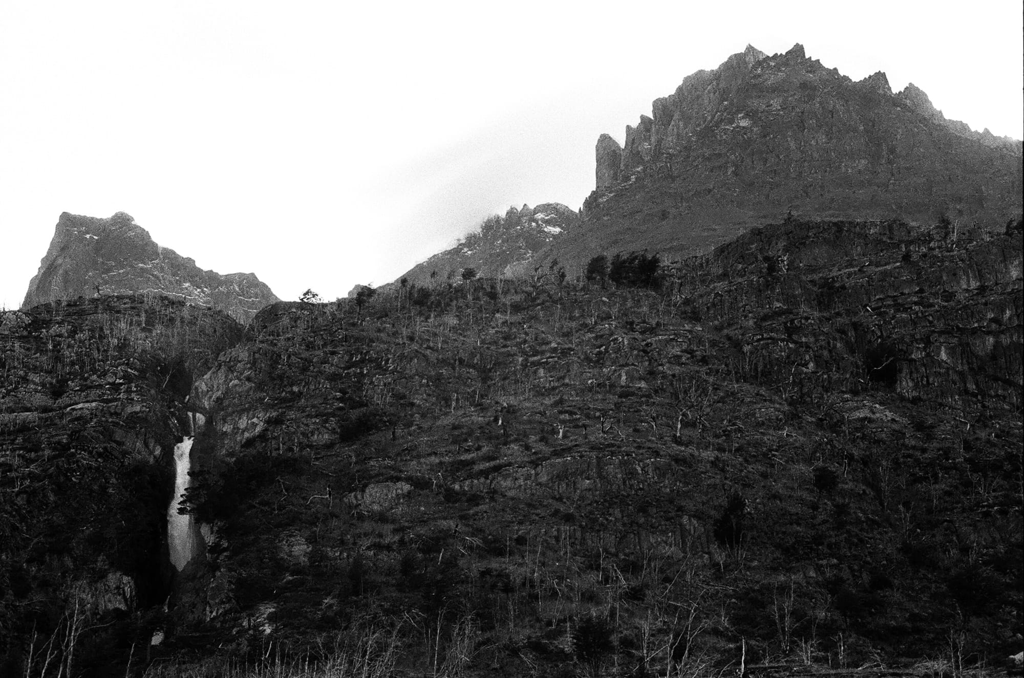
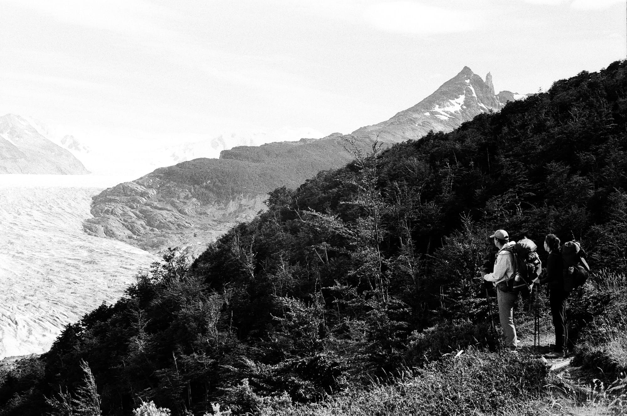
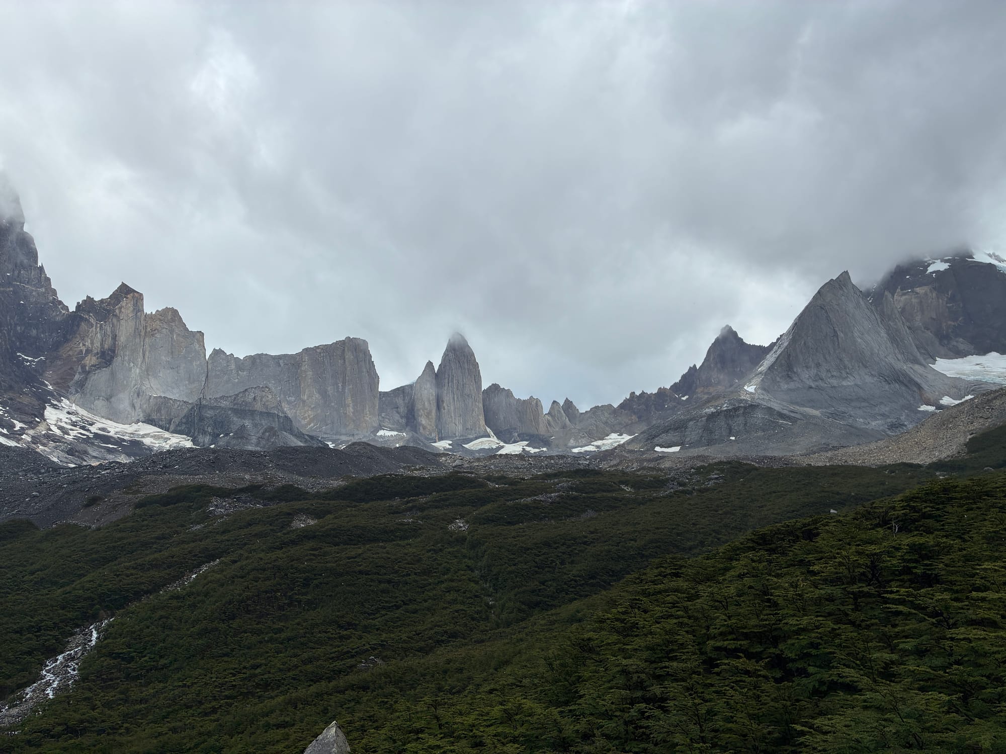
On Day 6, we had a nice morning hike through some drizzle and rainbows on the way to Mirador Brittanico. Unfortunately, the drizzle turned into a full-on downpour and this whole day was rain bound and foggy and we had little hope of seeing the viewpoint (mirador). But, we’ll be damned if we came all this way not to hike up and down the foggy ravine so we gutted out a wet and soggy hike along the Rio de Frances and past Glacier Frances. We initially thought the booming sounds every 10 minutes or so was thunder, but we realized this was glacial calving and avalanches from the glacier and we got to witness some pretty impressive calv-alanches all the way up to the mirador. As we took the final rocky steep ascent at Mirador Britanico, we were shocked to see blue sky! For about 20 minutes, the clouds cleared and we had exquisite views of Cerro Aleta de Tiburon (shark fin), Cerro Torre Blanco, Cerro Mascara, Cuerno Norte and Cuerno Principal. We left the lookout as the rain started again and trudged back along the same path down to the base of the ravine. There were hot showers at the Frances campsite and an elevated tent platform for us, which made for a nice hideout as we waited for the rain to stop.
We only had to cover about 10 miles on Day 7 but it really turned out to be a sneaky hard day. The walk started with some easy rollers but then after a walk along Lago Nordenskjod it took an abrupt ascent and the last 3 miles were a steady incline to Chileno Campground. Sadly, Alyssa wasn’t able to book this campground so she had to spend the night at the base, about 3 miles downhill from us at Chileno. When we got to camp that afternoon, we had to eat some Pringles, a Snickers bar, and drink a beer before we could even consider setting up our tent. The campsite was on about a 40 degree slope, so all of the tent sites were on wooden platforms about 10 feet in the air, which was fun. Until you have to pee at 1 am… We made plans to meet Alyssa by 5 am at Chileno for our final day and hopes for a view and sunrise at the iconic Baso de Las Torres, or The Towers. Meaning she would put in an extra 3 mile climb after a wakeup call of 2:30 a.m. Hey, it’s not an all inclusive beach resort, ok? The rain started as we went to bed and the forecast looked stormy in the morning.
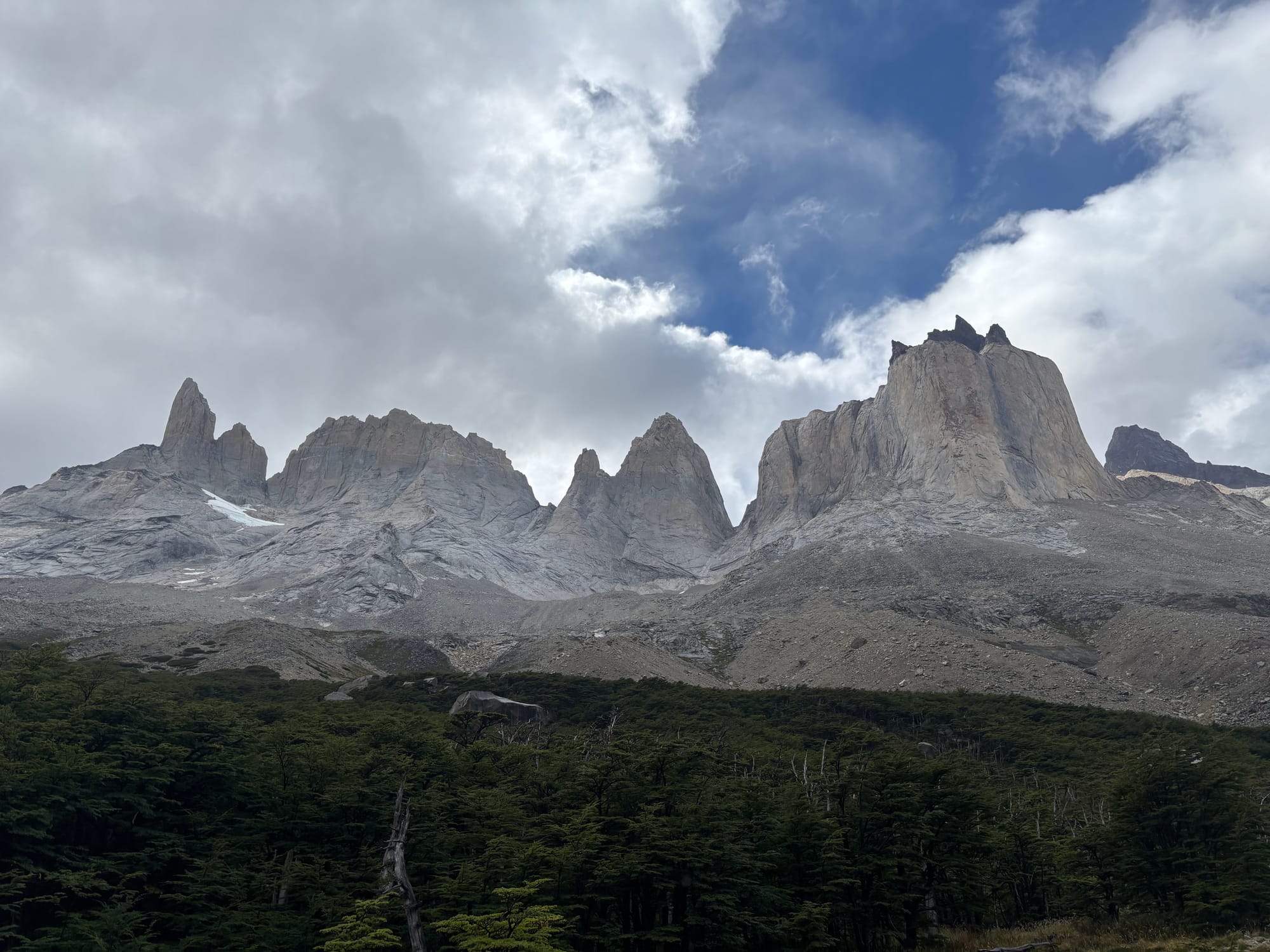
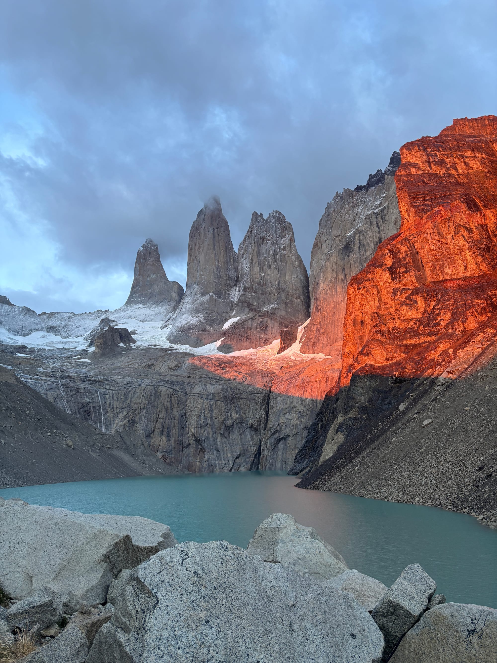
We were up at 4:30 and had camp broken down by 5:00 am. We were shocked to find Alyssa already drinking coffee at a picnic table! She walked with a fellow American O-trekker and felt better about not being Puma bait with his company. We put in about 2.5 headlamp miles in the rain (again, they feel like nothing) and the terrain turned alpine, steep, and exposed with about 3/4 of a mile to the top. When we got to the top at Lago Torres, the Towers were socked in with fog and a cold sleet and wind was hammering us. We had about 15 minutes to sunrise so Alyssa climbed into a cave and we huddled against a huge boulder waiting. Sunrise was officially at 7:14, at 7:05 Em said, “I think we should call it,” but gently accepted a compromise of at least waiting until sunrise. And a small miracle happened then, for the clouds and fog lifted, the rain stopped, patches of blue sky appeared, and Las Torres was illuminated in a bright orange glow. It was shocking and very unexpected. The weather held for about a half hour before the wind and rain started again so that was our cue to begin the long and final march down to the base, but spirits were high with a great mirador and we finished the entire hike at the visitor center, closing the 75-mile loop. It was really fun to watch the trickle of fellow O-trekkers cross the finish line and we had a group lunch with maybe 20 of us sharing burgers and beers at the visitor center.
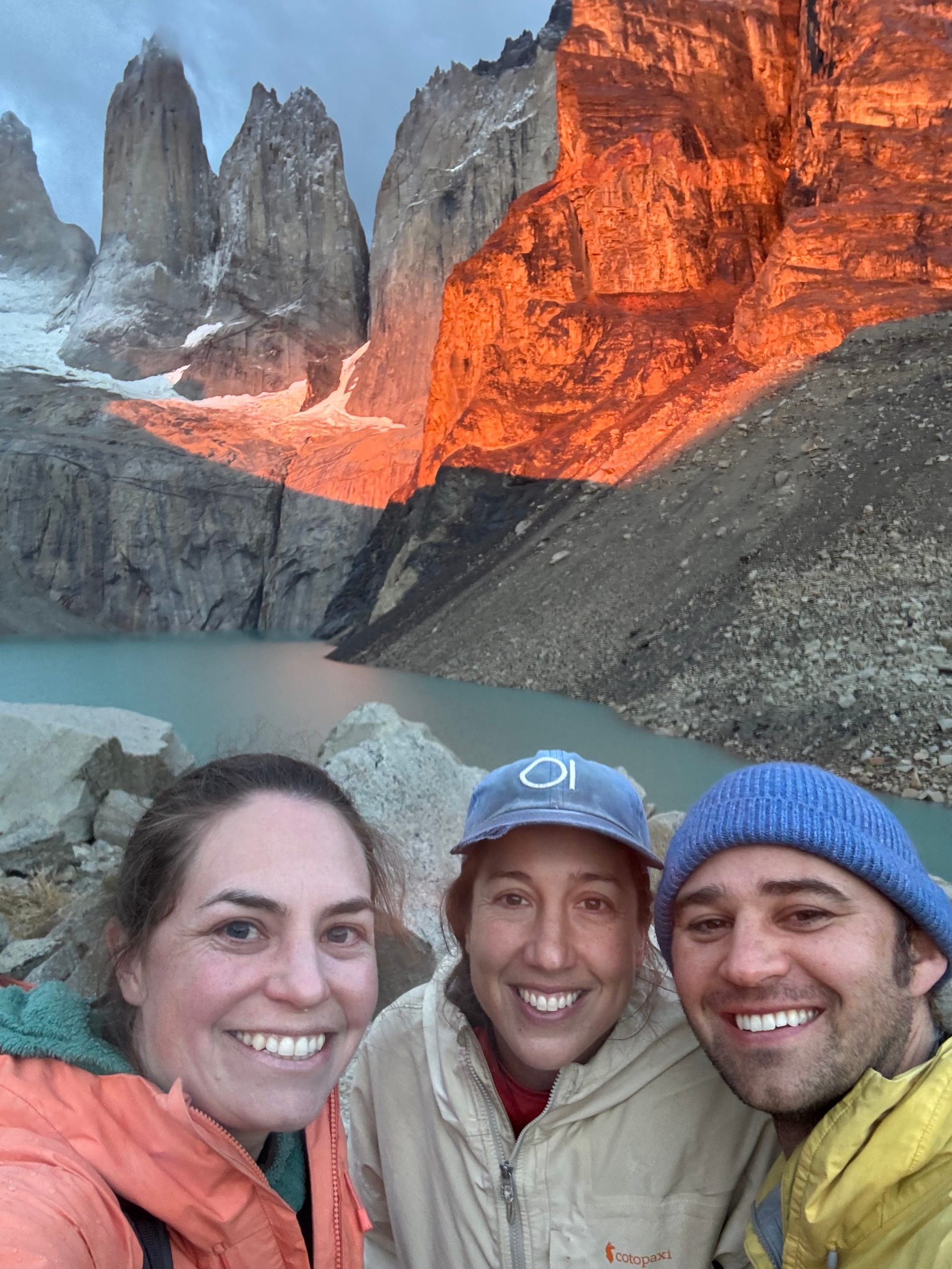
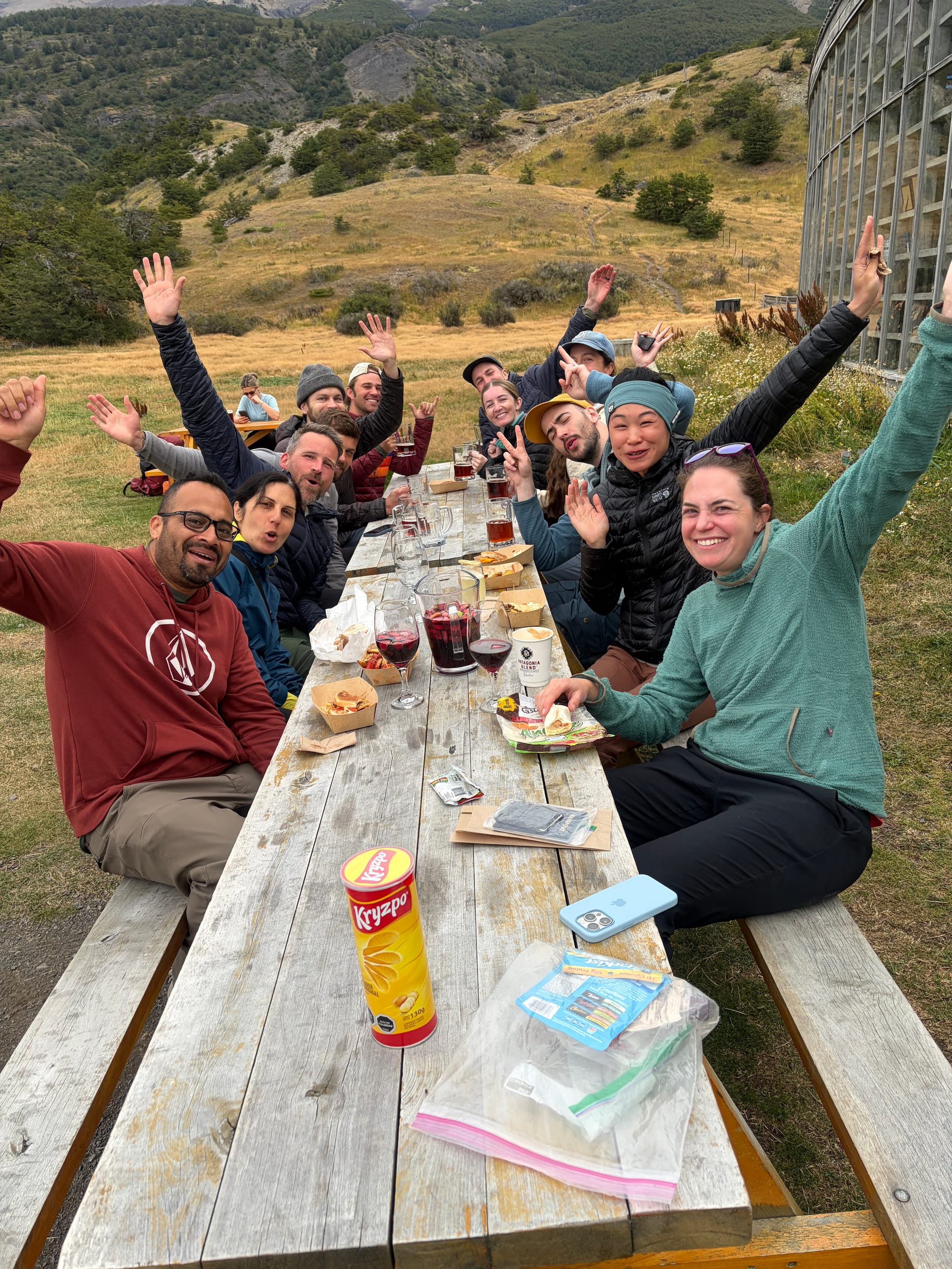
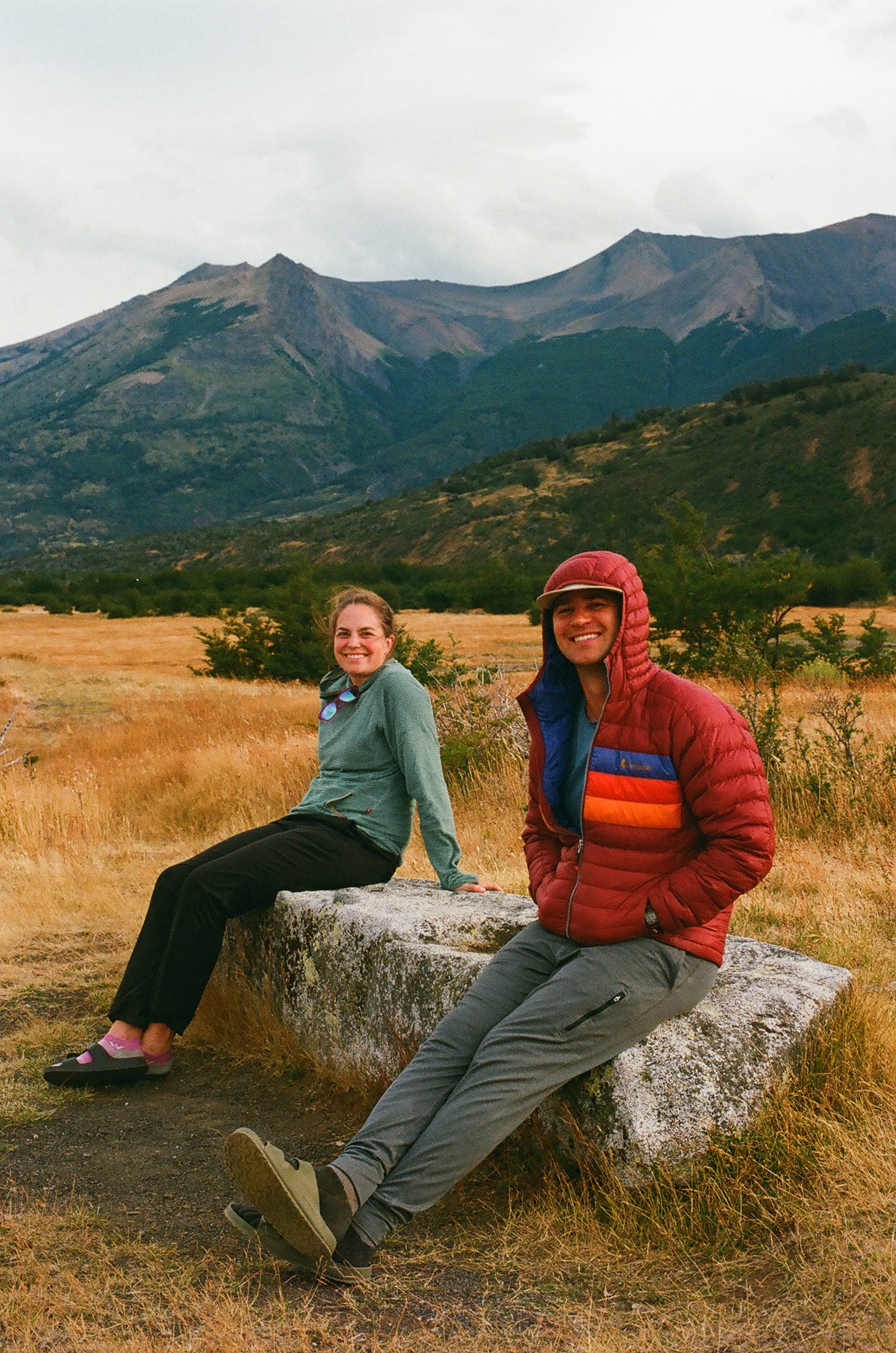
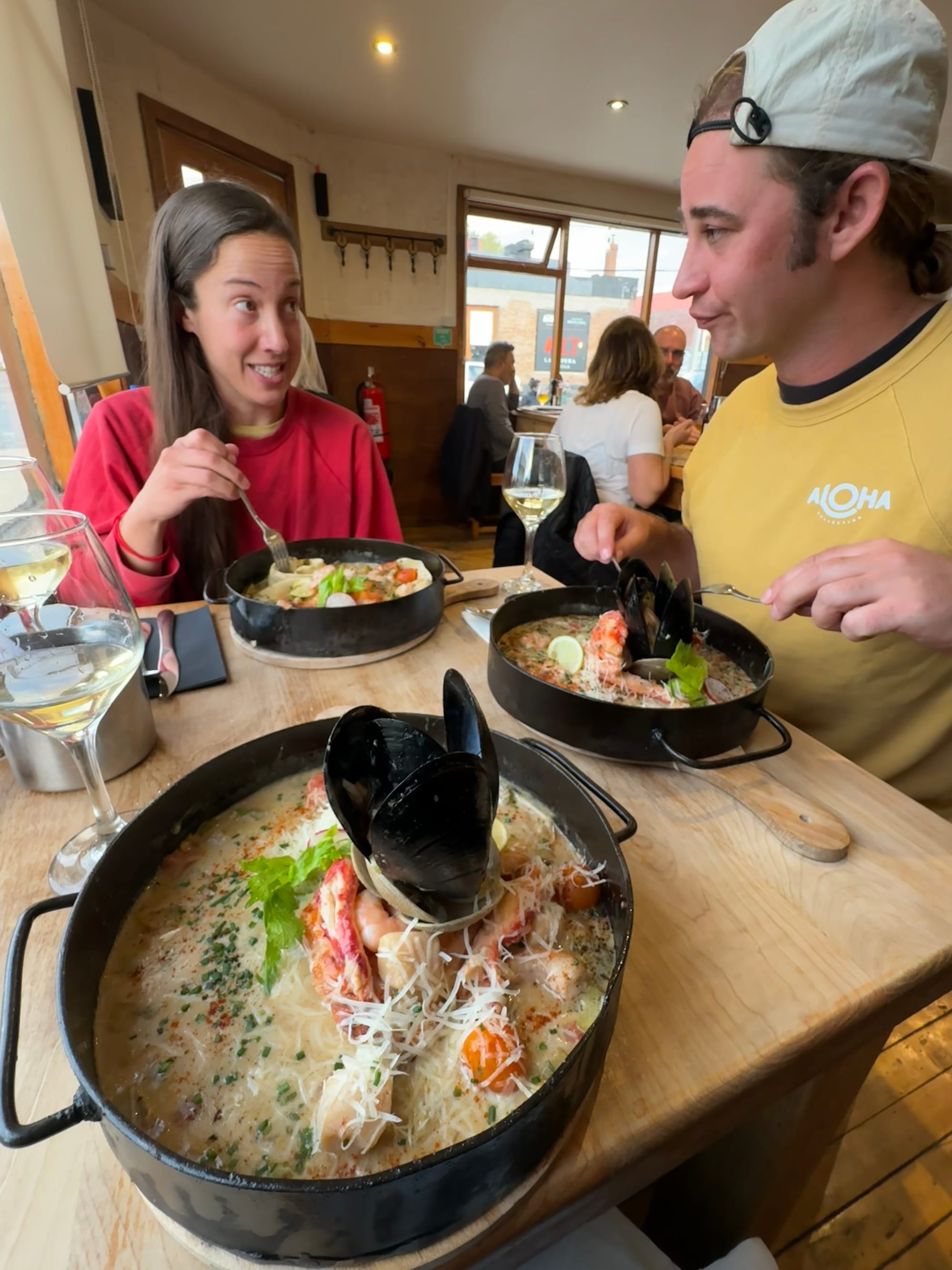
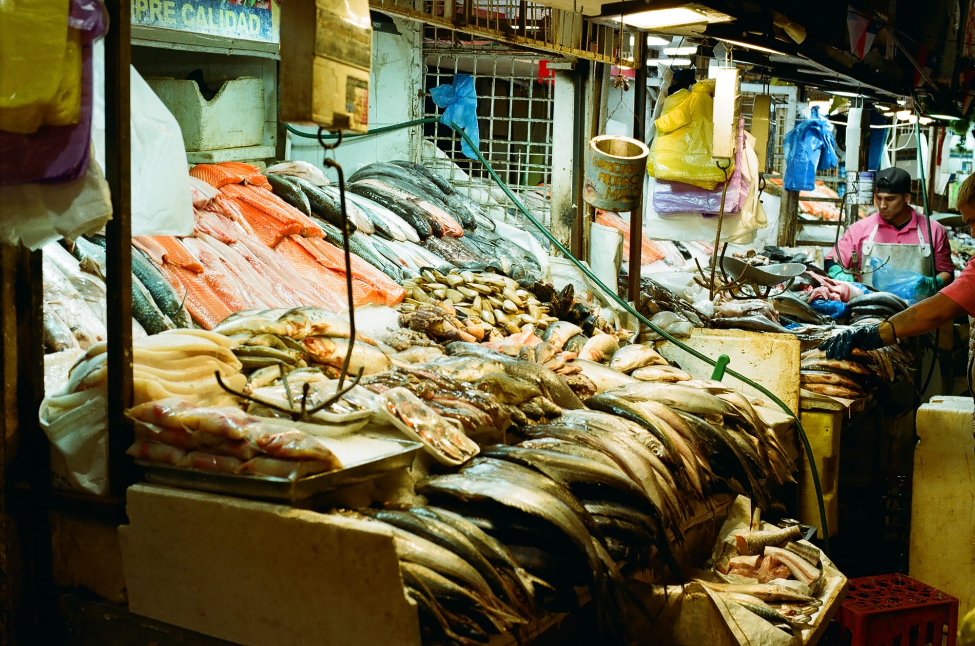
In retrospect, it’s not lost on us that it sounds like we had quite the posh hike, and that is true. Even though we carried all of our meals and tent and gear, the fact that we were able to enjoy some creature comforts on most days made things much easier. But, these were serious miles and elevation gain and we were happy to have a couple of rest days in our near future. When we were in Puerto Natales before the O-trek, we had scoped out possible restaurants for our post-trek celebratory meal and we landed on La Disqueria. Literally, it just sold giant disks of seafood. There is nothing that we crave more than the completely impossible or unobtainable while in the backcountry and the most out of reach food of them all is seafood pasta. So as you can imagine, this was a special meal. We sadly bid farewell to Alyssa who made her journey back to Minneapolis from Puerto Natales as we started our slow journey North to our next stop at El Chalten.
The 6-hour bus ride back to El Calafate and another 2 hour bus ride to El Chalten were actually not too miserable as we wanted to do nothing more than sit and give our legs a break. We had planned to give ourselves 10 days in El Chalten to increase the odds of having a good weather window for hikes. The first 3 days were rainy, windy, and cold. Em was stricken with post-trek illness so we spent the time watching the rain in a makeshift Airbnb infirmary.
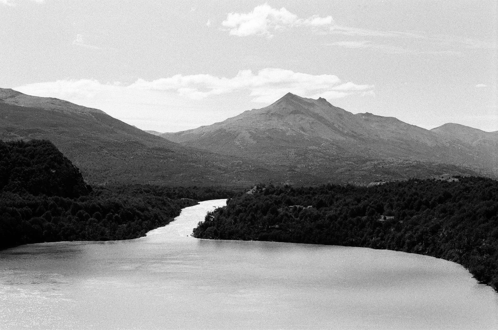
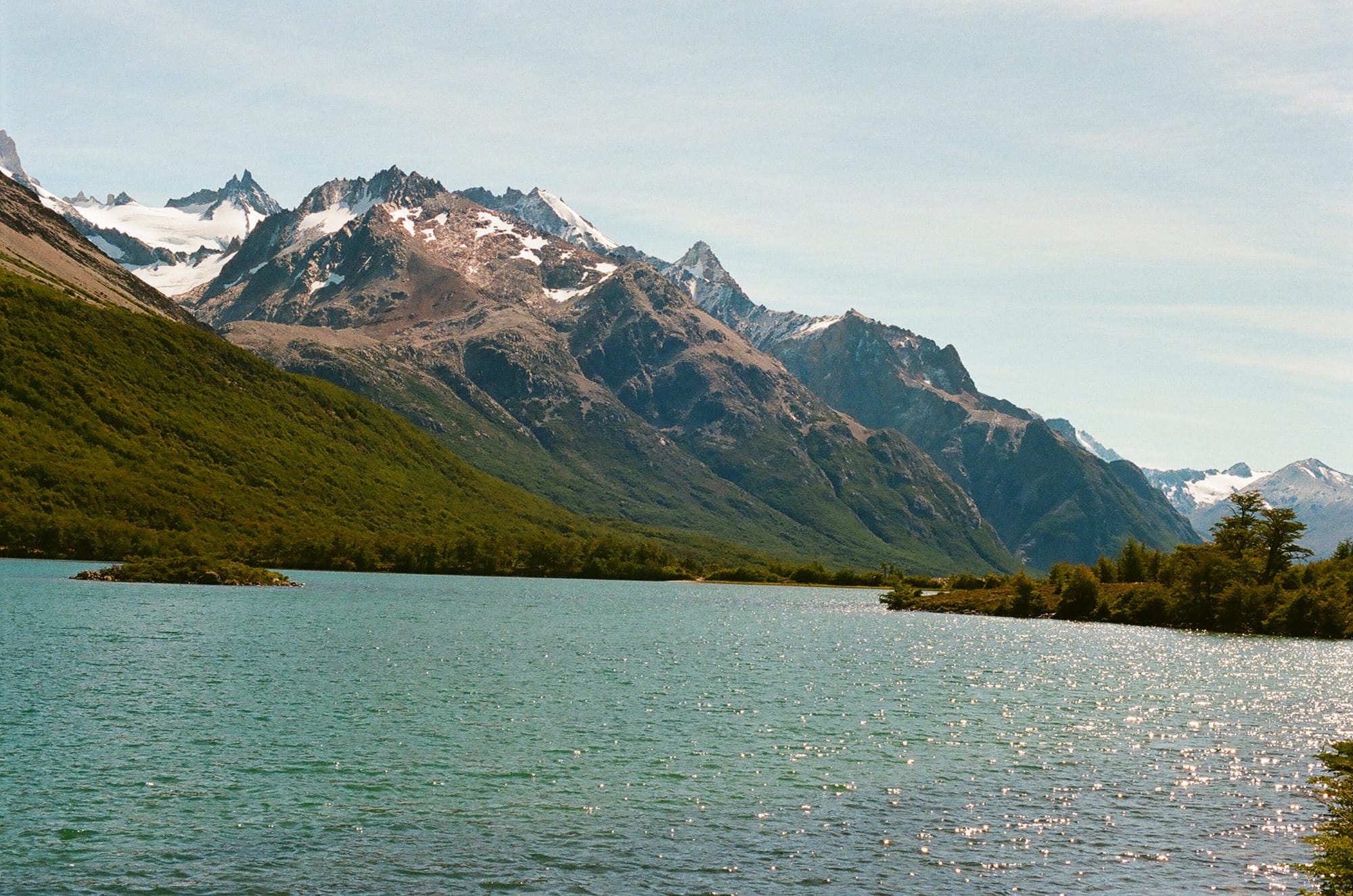
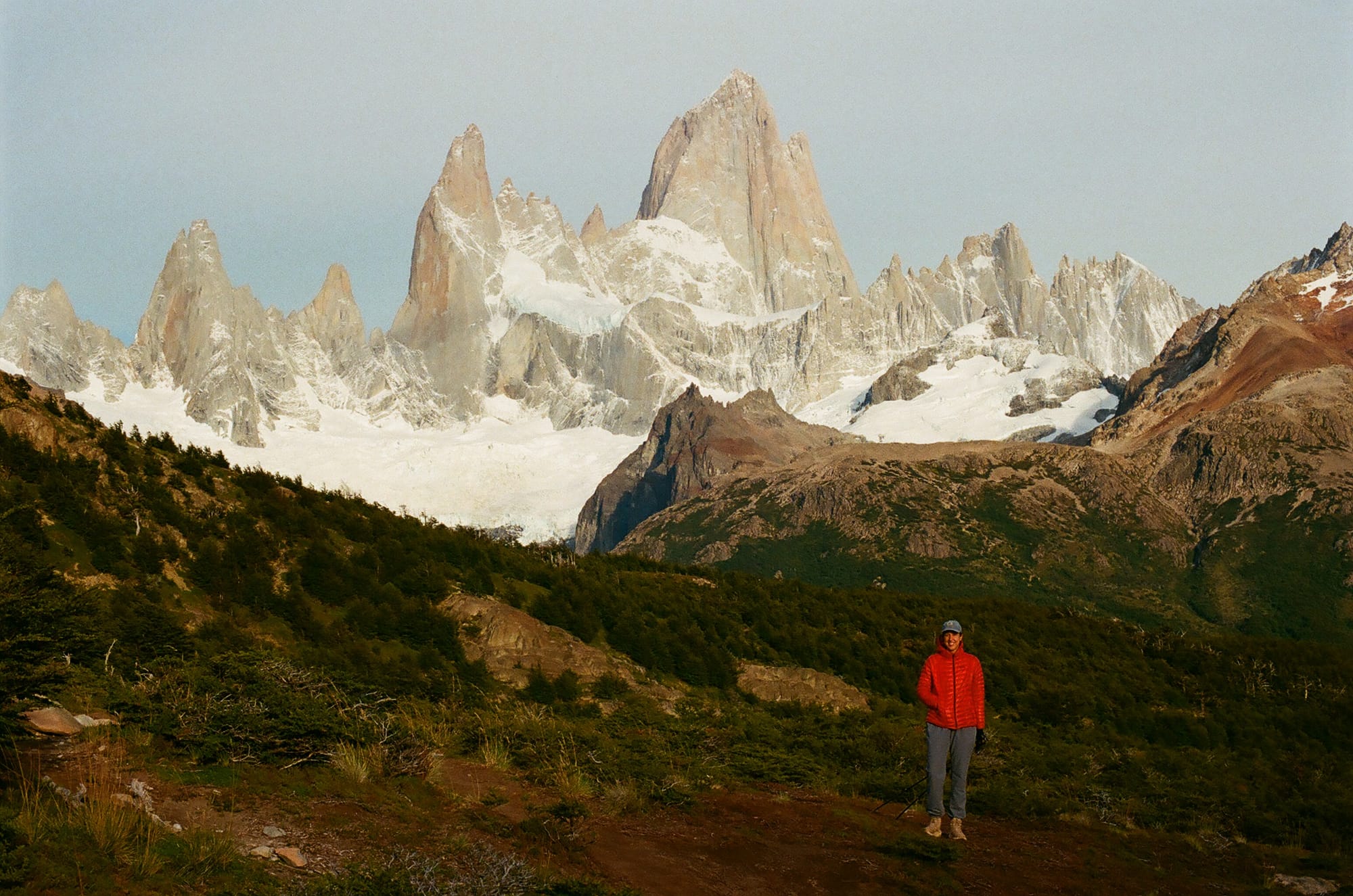
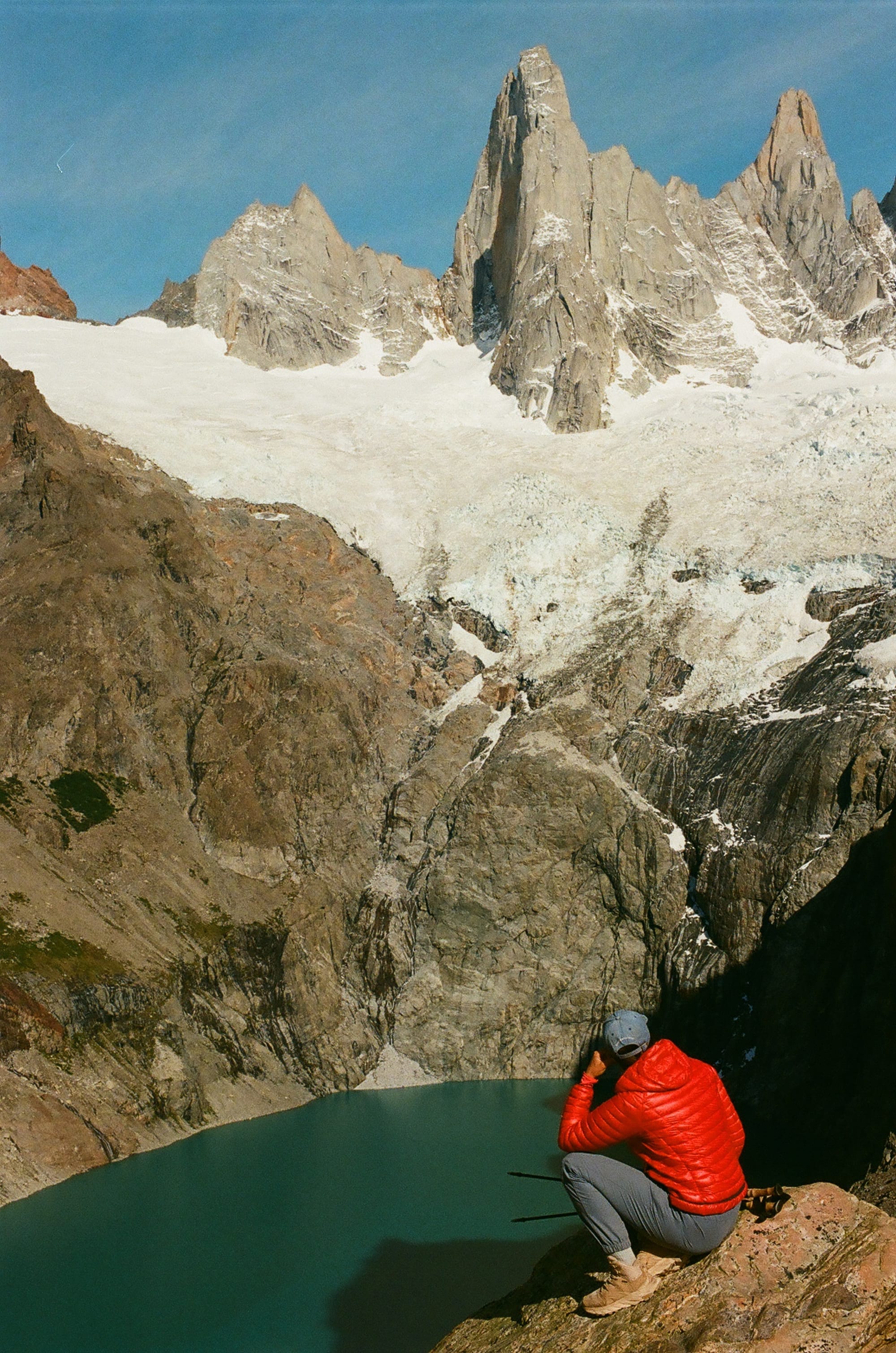
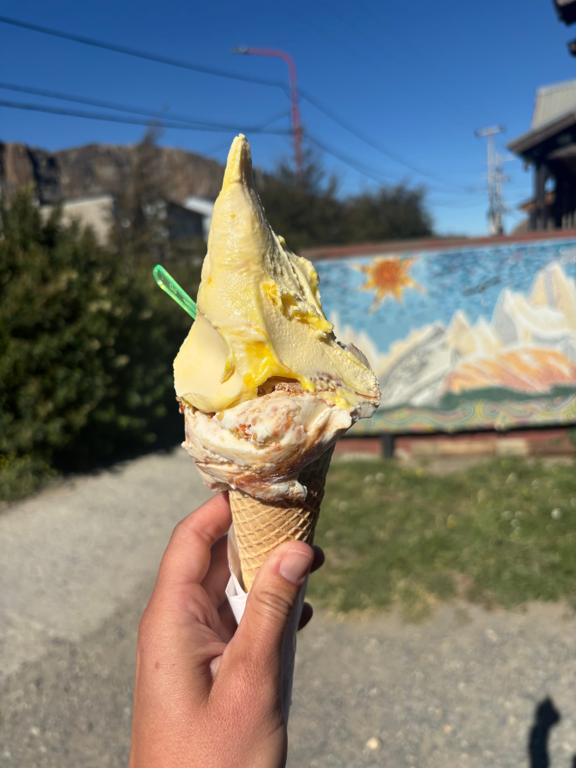
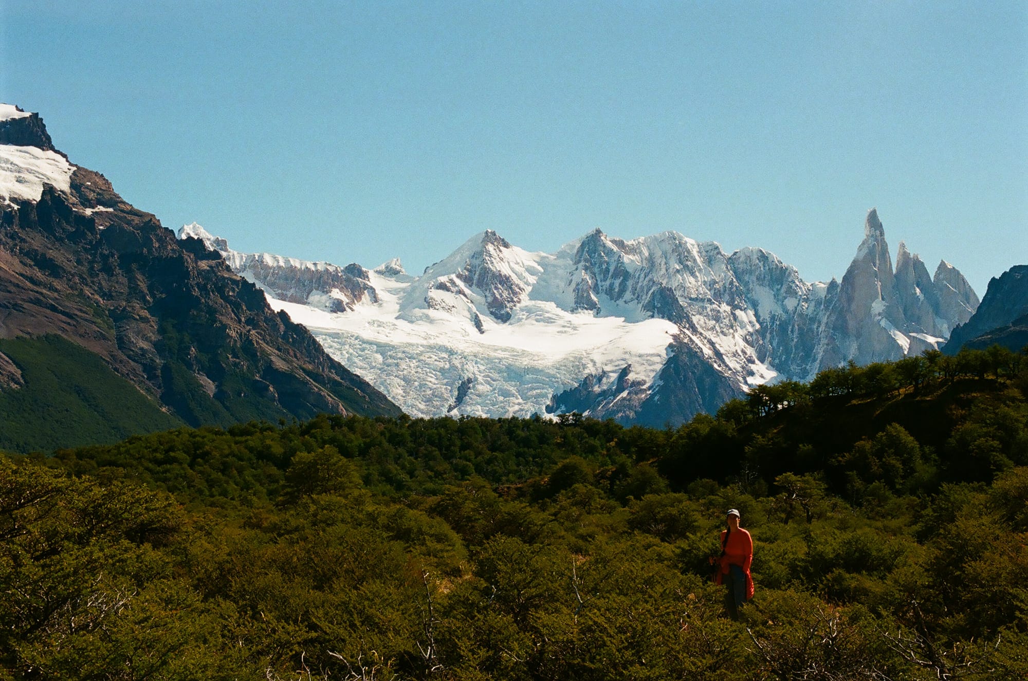
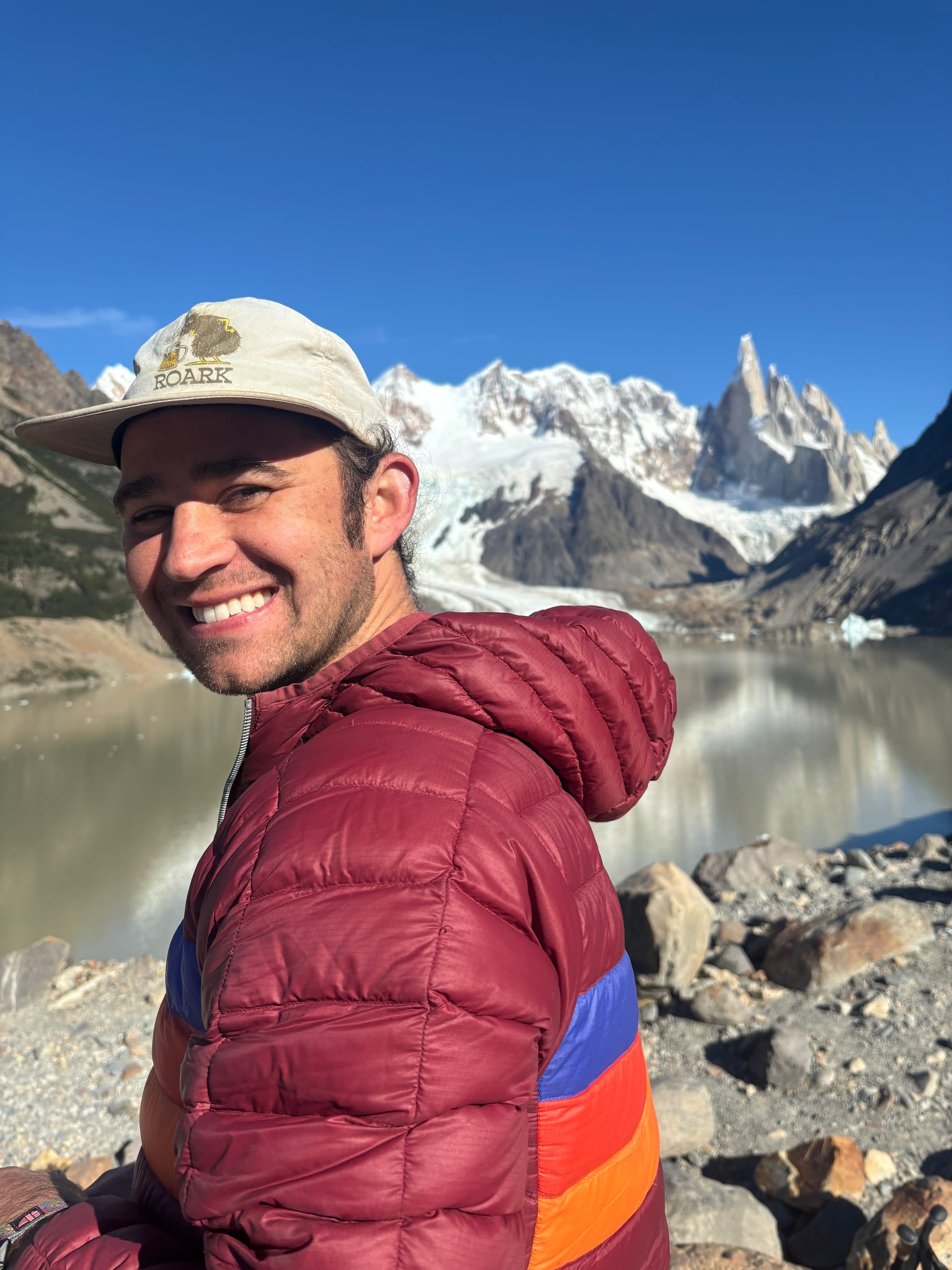
Our first hike in good weather was up to Fitz Roy via Lago de Los Tres because this offered the most iconic views. We started at about 6 am and saw the sunrise over Fitz Roy from afar- a striking blue bird day! By the time we made it to the viewpoint, it was time for lunch and we ate on the shores of Lago de Los Tres with Fitz Roy looming above us. The iconic peak stands proudly and boldly above Lago de Los Tres with the a glacier to the east- Piedras Blancas- spilling onto the shores of the lake. We also wanted to make sure to see Cerro Torre, so we descended and took the cutoff past Lagos Hija and Madre instead of the way we came and were treated to our first views of Cerro Torre in the distance. Cerro Torre is sharper and thinner than Fitz Roy, like a church steeple, and although not as formidable as Fitz Roy, it was still profound to see. It has an impressive glacier as well, Circo de los Altares, which leads to the Southern Patagonia Icefield, the same 350 km icefield that we stared at, slack jawed, on the O-trek, a 9-hour bus ride and 4 days hike away. We probably could have done ourselves a favor and packed another meal but instead we hobbled back into El Chalten after a 19-mile day quite peckish. Luckily, we found an ice cream shop with some incredible passionfruit gelato. It may be the mileage talking, but we can’t recall a better scoop anywhere.
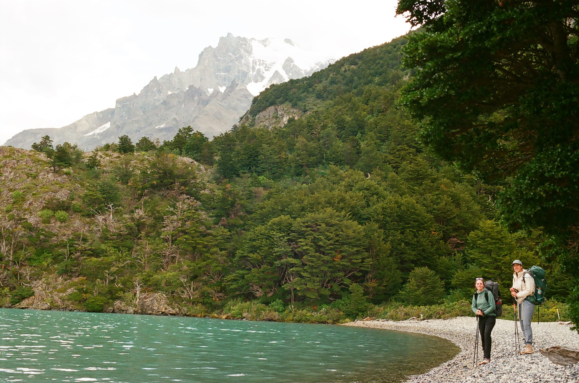
Our next hike in the good weather window was to Laguna Torre, which lies right at the base of Cerro Torre. We had actually walked most of this trail the day prior as part of the long 19-mile loop, but we could not bring ourselves to put in another 3 miles uphill to see the lake and view. This day was a 10.5 mile hike and, compared to yesterday, was very nice and straightforward. We again started early and saw sunrise across the face of Laguna Torre from a distance. We heard the calls of the Huemul deer at dawn and we had a nice stroll through the woods before breaking through to our steep and rocky ascent to Laguna Torre. The lake here is cloudy and silty but holds many huge icebergs that have broken off from the nearby Circo de Los Altares glacier. More yellow-crested caracara were waiting at the top to feast on unwitting hikers’ snacks and just as we reentered the subpolar forest, we had an exciting glimpse of the iconic Magellanic Woodpecker.
Magellanic Woodpecker sighting!
Our last long hike in El Chalten was to Loma del Pliegue Tumbado which leads up to Cerro Solo but offers views looking over Laguna Torre, Cerro Torre, and Fitz Roy from a different angle. We again planned for sunrise near the summit so we had an early morning and 5.5 miles steady ascent to the summit. The forecast here promised clear skies but unfortunately as the sun rose, we were greeted with a soupy fog that covered all view points. The hike was still cool and we had no wind which was a rarity there, and we were very grateful to have logged a lot of miles the previous two days to get the views that we came here for. Just as well, because our last few days in El Chalten were stormy, rainy, cloudy, and cold. It is just a matter of pure luck to get any decent string of days here, even in peak summer!
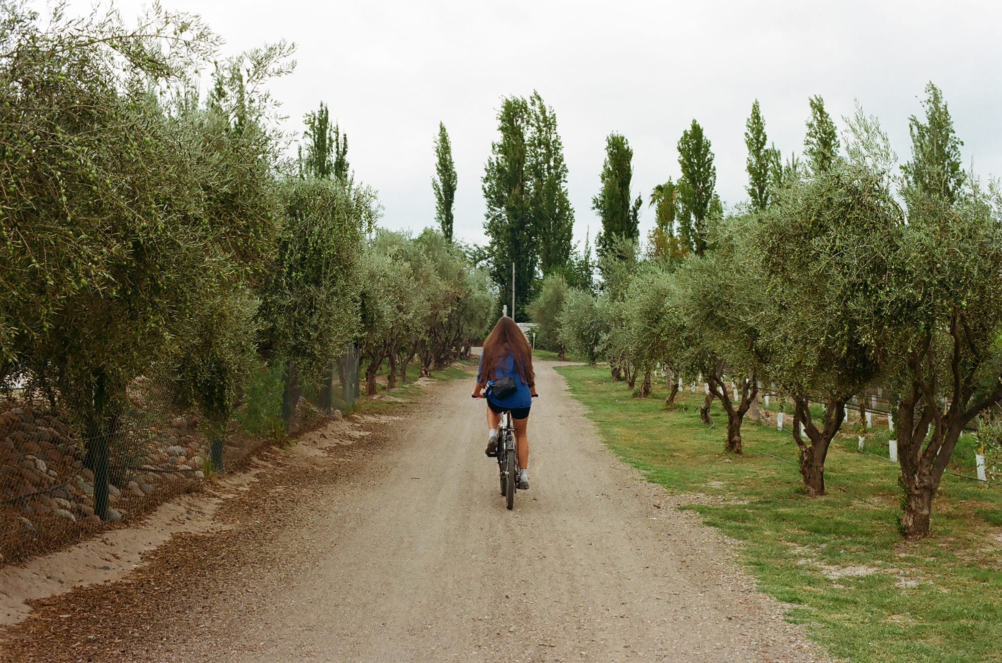
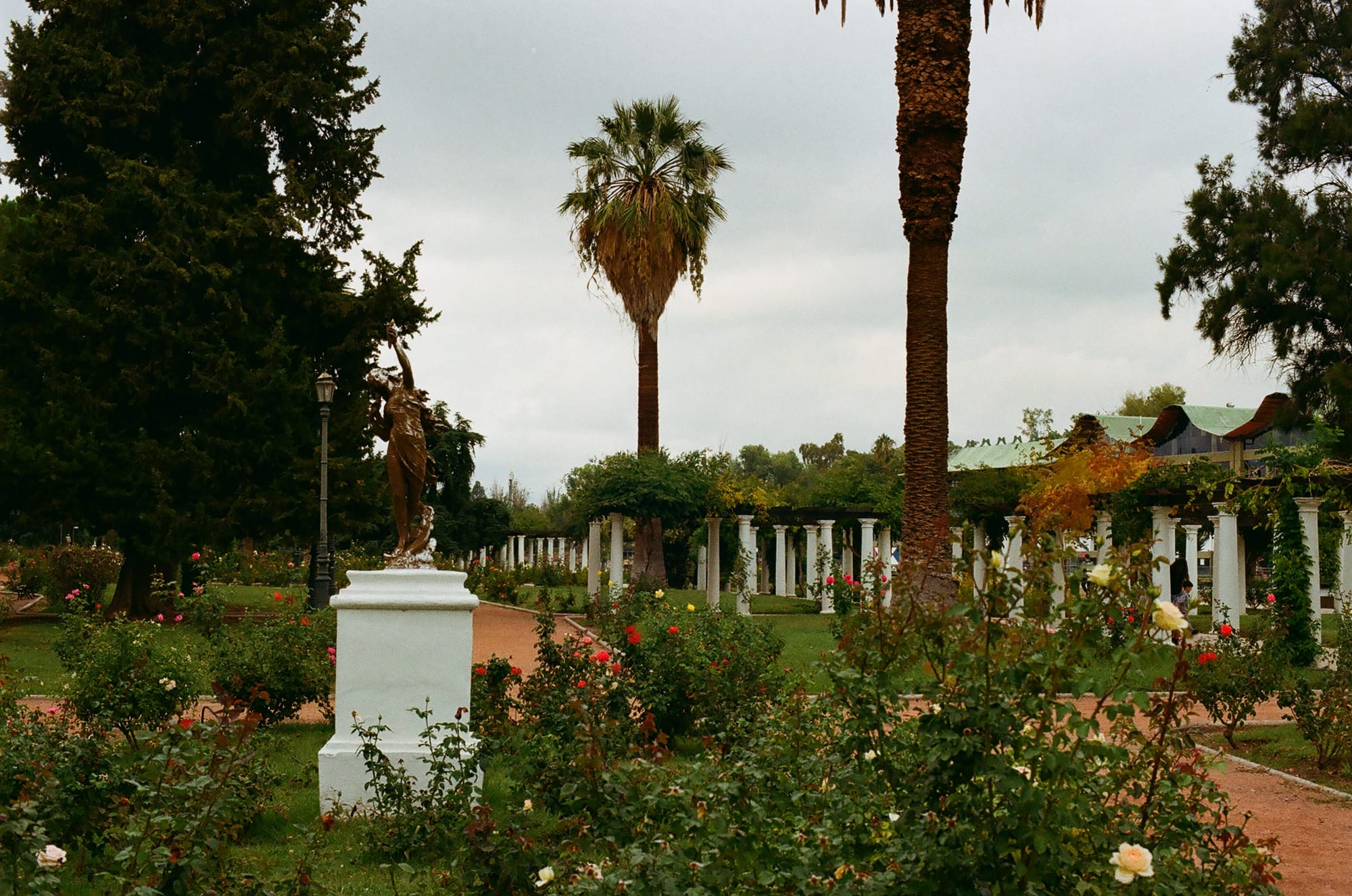
From El Chalten, we took our bus journey back to El Calafate and flew to Mendoza in central Argentina. Mendoza was a nice change from the brutal weather of Patagonia and is famous for its Malbec grapes. We rented bikes and went on a vineyard crawl. We explored Mendoza’s many nice parks and squares, the main one being the huge Parque San Martin where it felt like all of Mendoza went for riverside walks and exercise and to admire the rose gardens.
From Mendoza, we rented a car and drove to Portrerillos, about an hour northwest. The house we rented was perched in the hills in a desert landscape above Lago Portrerillos. We had the sharp Andes mountains on all sides in the distance. This house also had a traditional Argentinian Parilla which Rory used on our first night. After almost a month in Argentina and Chile, he really leaned into the gaucho spirit and made a decent parilla steak and chicken.
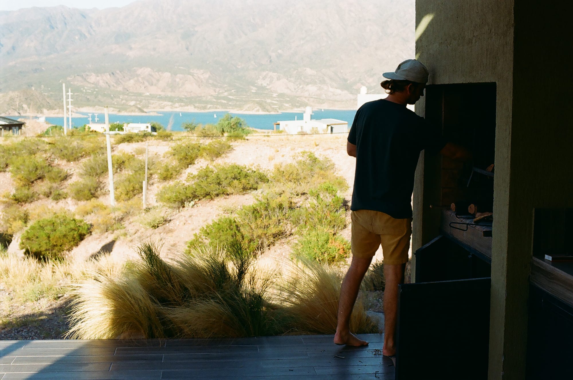
The parilla is crankin’
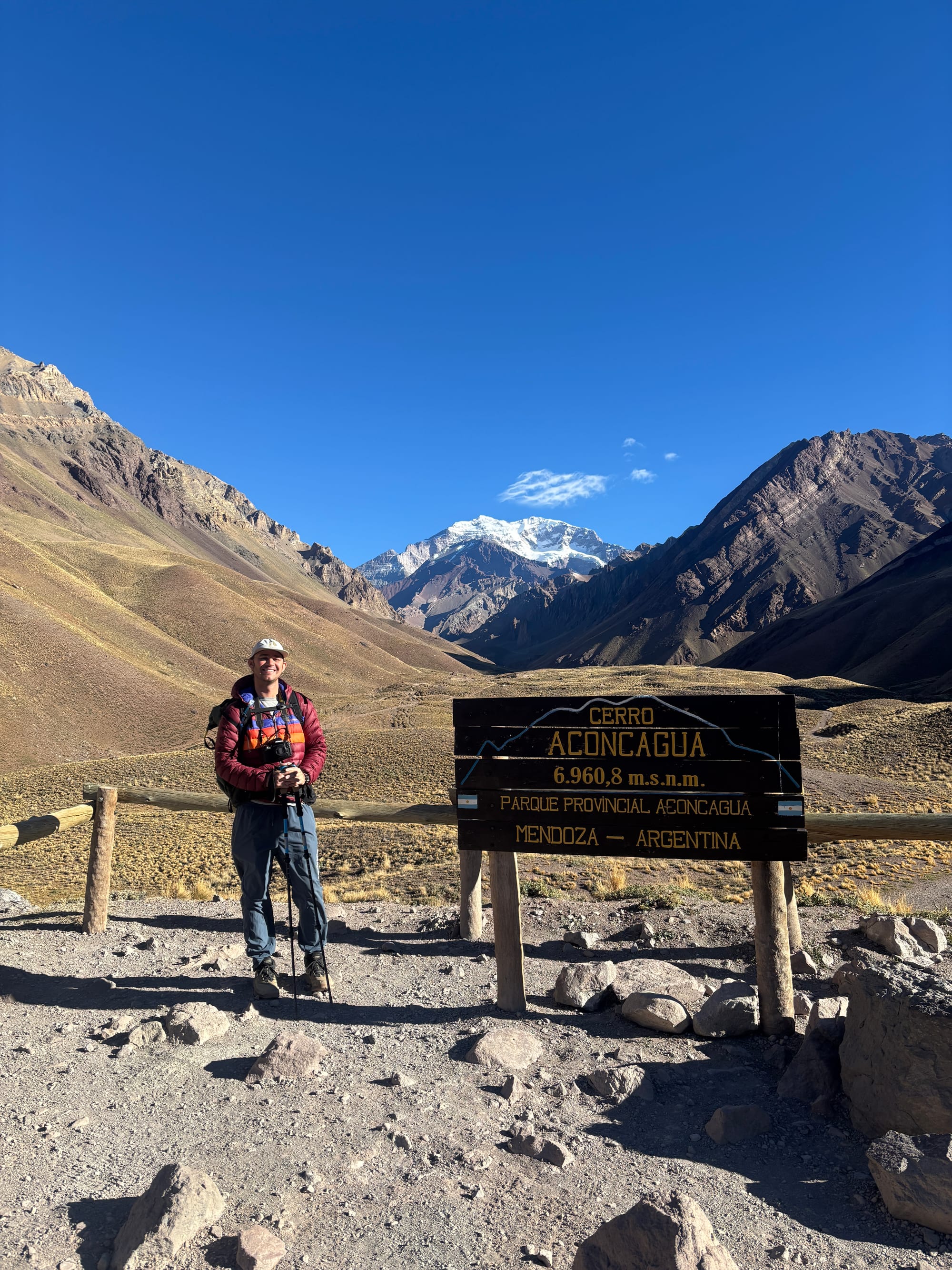
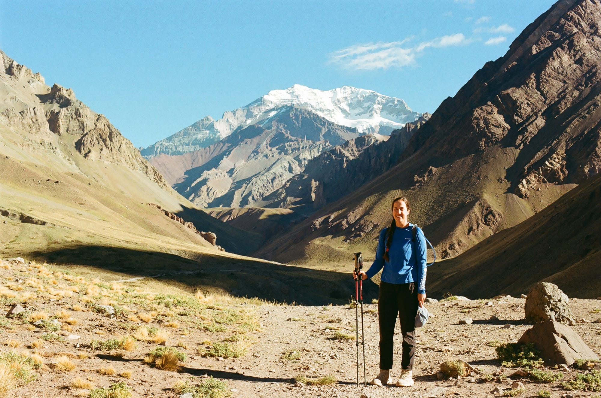
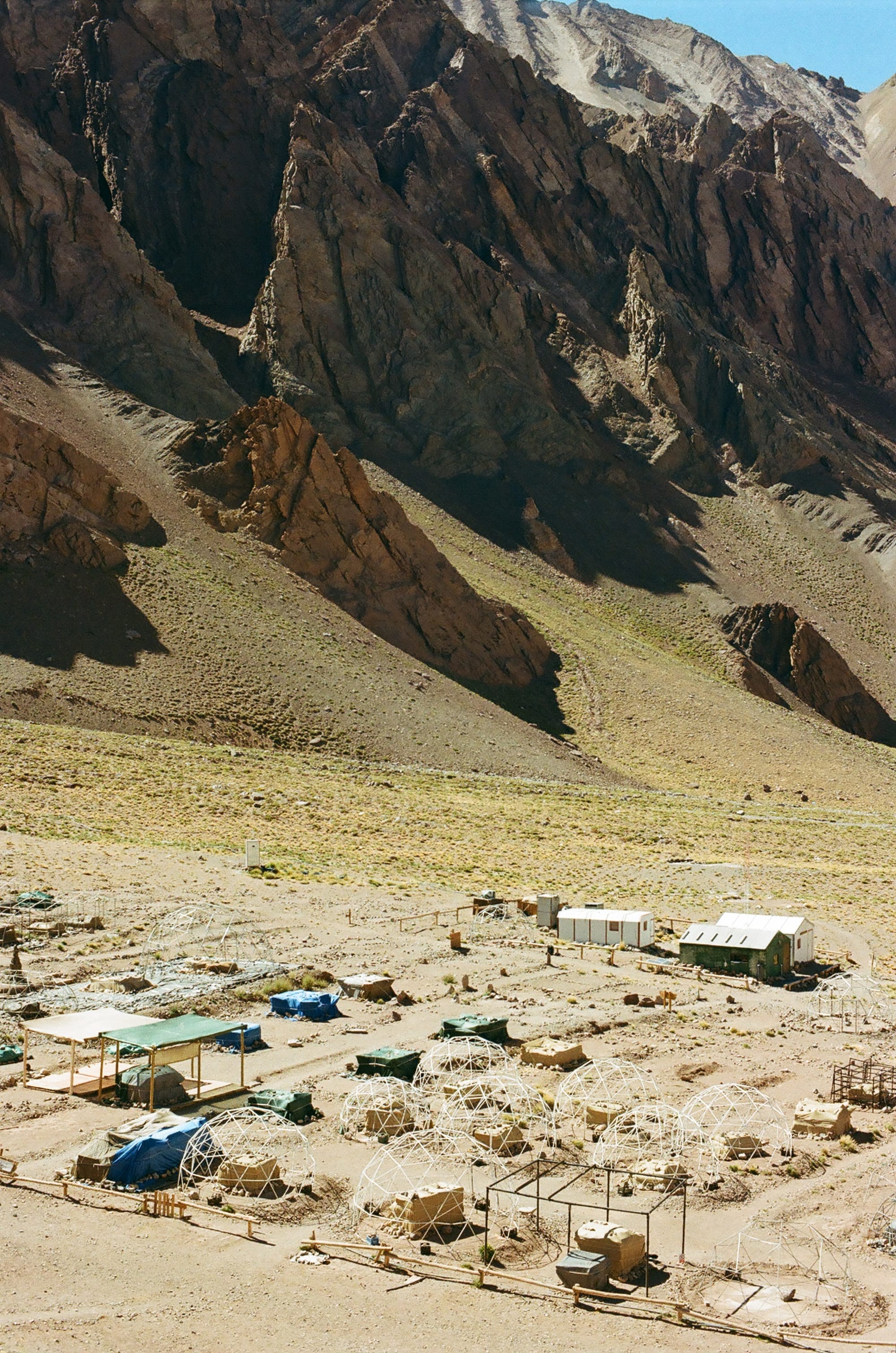
We had a 2 hour drive further northwest to Aconcagua National Park where we started the hike to the base camp of Mt. Aconcagua, one of the 7 summits and the tallest mountain in South America. The first steps on the trail were shocking and we were immediately short of breath at this new altitude- just shy of 10,000 feet at the trailhead and we had a slow pace over the next 4.5 miles along the Horcones River. It was a steady climb up to Confluencia base camp at 11,500 feet and while not technical or exceptionally steep, the altitude made us feel this one. The near constant view of Aconcagua was worth the effort and it was also neat seeing base camp off-season (it is fall here now and too late to start the 21-day trek to the summit of Aconcagua).
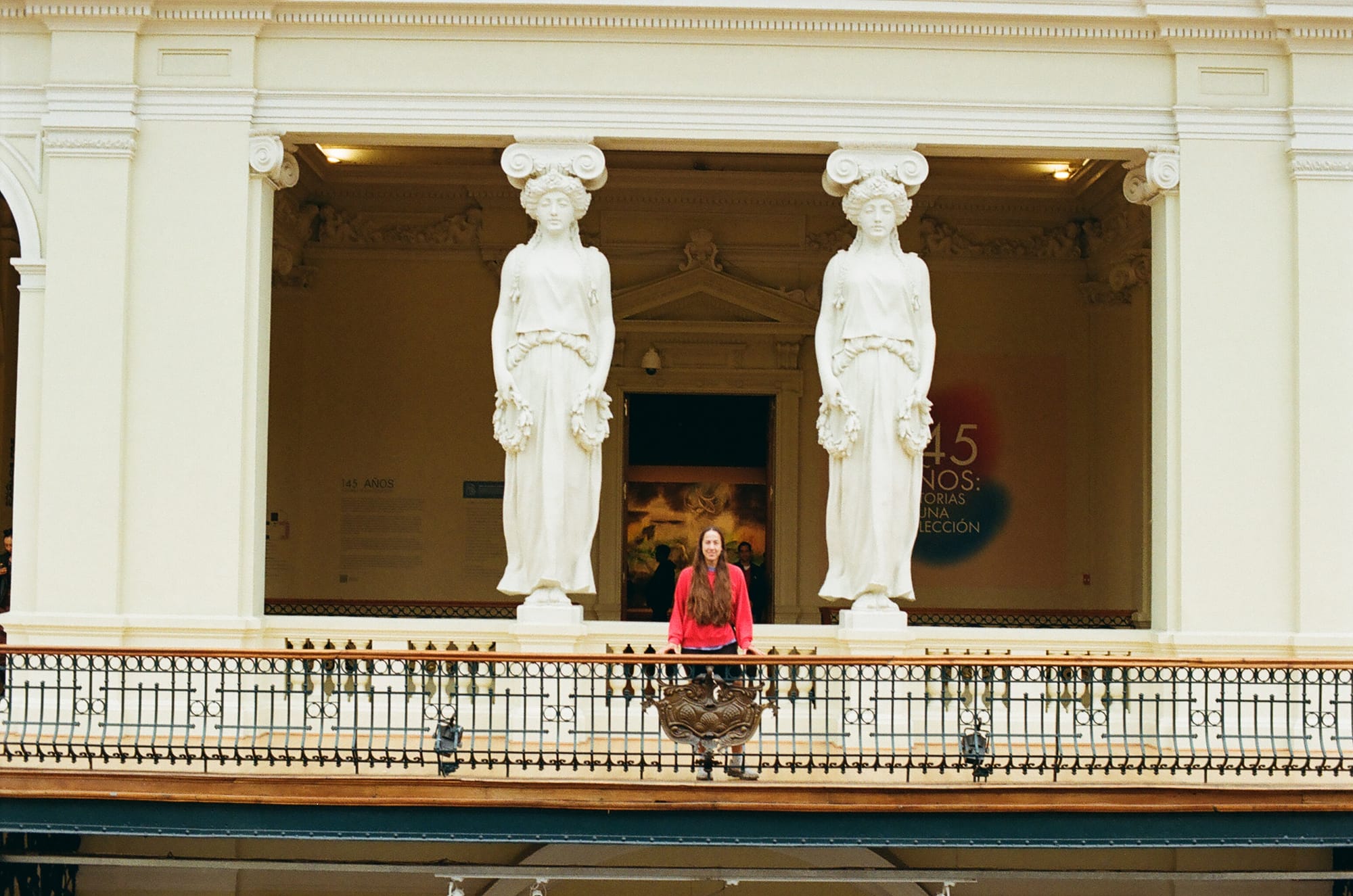
From Mendoza, we took a flight to Santiago, Chile and stayed there for three days. Being a capital city, it was huge and dirty and rough around the edges. But, we took the opportunity to eat something other than traditional Chilean food and went to a surprisingly great Chinese pulled-noodle house, a Thai restaurant that did not fuck around with their spice level (Ror was proud to have earned a photo on the Spice Wall of Fame here. He definitely didn’t suffer any severely uncomfortable consequences from this), and a great Peruvian ceviche restaurant. It was also the first place in a long time that had a lab to develop film!
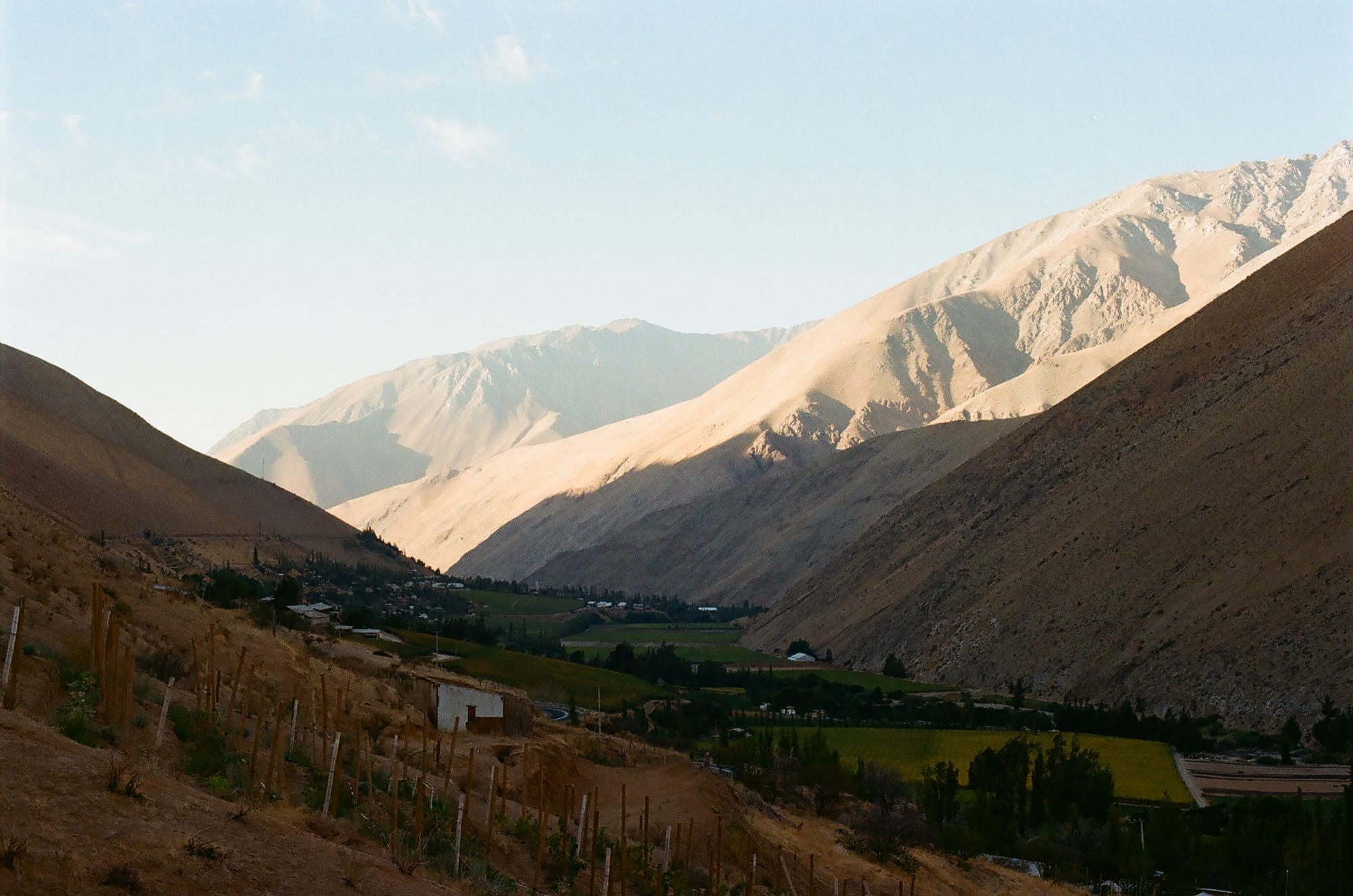
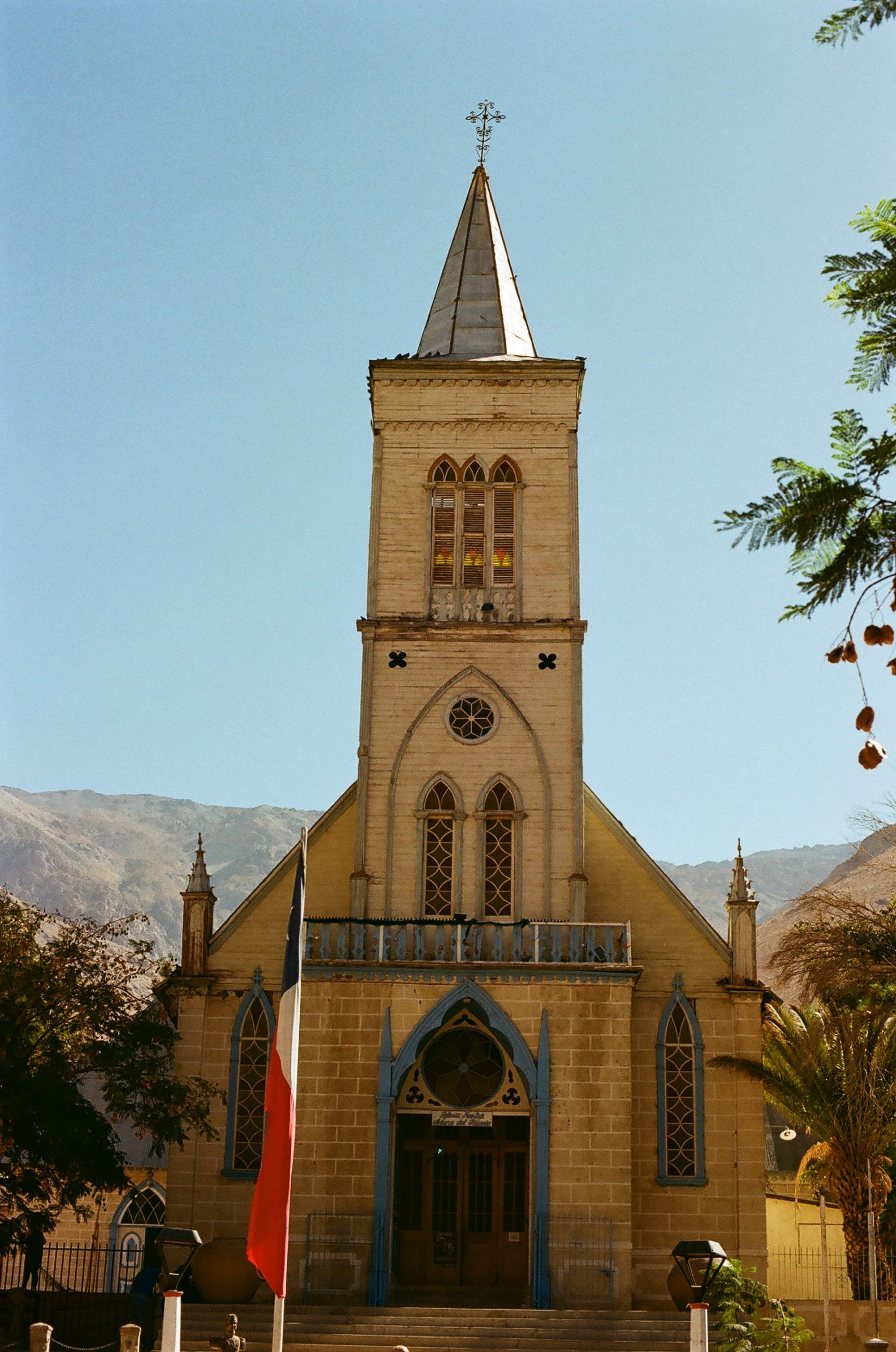
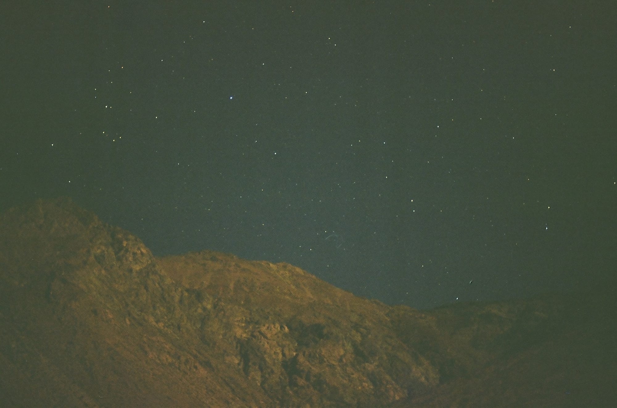
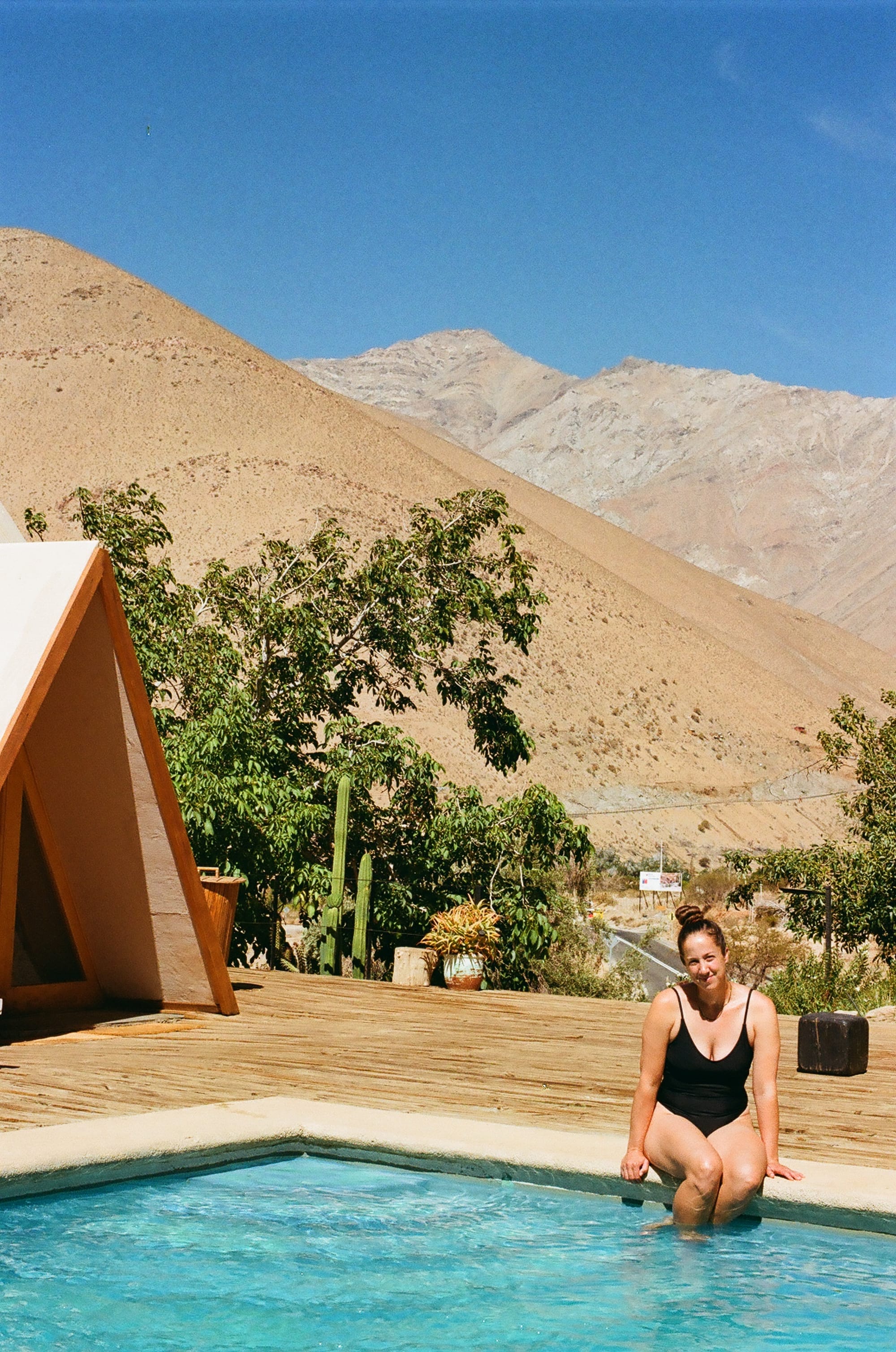
We rented a car from Santiago and started our road trip north along the Chilean coast to the southern edge of the Atacama desert region. We wanted to get out in the desert and see some stars and drink some Pisco. Apparently, there is a contentious debate between Chile and Peru about the origin of Pisco, which is a grape-based brandy that before our trip here to Chile we associated with Peru. But, our destination about 7 hours north of Santiago was the small town of Pisco Elqui where they have the coastal valley grapes for the liquor, and all Chileans insist that this valley is the birthplace of the much beloved booze. We are completely free of bias and believe the Chileans. There is literally only stargazing and Pisco grapes in Pisco Elqui, and even a Pisco Museum.
We headed to the airport feeling strange to be leaving after such a long time in the region. Argentina and Chile are both massive countries with their own distinct dialects, food, wildlife, and cultural practices, but being able to share an experience like hiking Patagonia throughout both unites them in our minds. That, and their love of stray pups.